
Pricing Change
New pricing for orders of material from this site will come into place shortly. Charges for supply of digital images, digitisation on demand, prints and licensing will be altered.
Upcoming Maintenance
Please be advised that this website will undergo scheduled maintenance on the following dates:
Thursday, 9 January: 11:00 AM - 3:00 PM
Thursday, 23 January: 11:00 AM - 3:00 PM
Thursday, 30 January: 11:00 AM - 3:00 PM
During these times, some functionality such as image purchasing may be temporarily unavailable. We apologise for any inconvenience this may cause.
Muir Of Dess


Earthwork (Period Unassigned)
Site Name Muir Of Dess
Classification Earthwork (Period Unassigned)
Alternative Name(s) Tilphoudie; Drumduan
Canmore ID 128902
Site Number NJ50SE 47
NGR NJ 5588 0123
Datum OSGB36 - NGR
Permalink http://canmore.org.uk/site/128902

- Council Aberdeenshire
- Parish Aboyne And Glentanar
- Former Region Grampian
- Former District Kincardine And Deeside
- Former County Aberdeenshire
NJ50SE 47 5588 0123
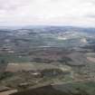
Air photography (AAS/98/01/G1/3-5 and AAS/98/01/CT, flown 27 January 1998) has recorded an embanked feature of roughly circular form on a gentle slope in an area of rough grazing at an altitude of 160m OD. It may be all that remains of a pond or related to the field-system NJ50SE 48 [GRC: 47].
NMRS, MS/712/31.
The following site was recorded during winter aerial reconnaissance:
NJ 558 012 Circular embanked feature, ?pond (NJ50SE 47).
Sponsors: Aberdeenshire Council, RCAHMS
M Greig 1998

