Scheduled Maintenance
Please be advised that this website will undergo scheduled maintenance on the following dates: •
Tuesday 3rd December 11:00-15:00
During these times, some services may be temporarily unavailable. We apologise for any inconvenience this may cause.
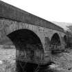
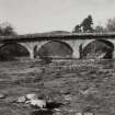
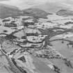
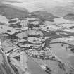
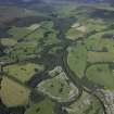
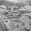
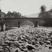
Blair Atholl, Bridge Of Tilt
Road Bridge (Period Unassigned)
Site Name Blair Atholl, Bridge Of Tilt
Classification Road Bridge (Period Unassigned)
Alternative Name(s) River Tilt
Canmore ID 128616
Site Number NN86NE 48
NGR NN 87577 65521
Datum OSGB36 - NGR
Permalink http://canmore.org.uk/site/128616
- Council Perth And Kinross
- Parish Blair Atholl
- Former Region Tayside
- Former District Perth And Kinross
- Former County Perthshire
NN86NE 48 87577 65521
Bridge of Tilt [NAT]
OS 1:10,000 map, 1989.
For predecessor Old Bridge of Tilt (NN 8761 6642), see NN86NE 27.
EXTERNAL REFERENCE:
Scottish National Portrait Gallery
S.M.T. Magazine, November 1951 - Page 21 - Photo.
(Undated) information in NMRS.
(Location cited as NN 876 656). Bridge of Tilt, early 19th century. A large 3-span rubble bridge, with segmental arches.
J R Hume 1977.
This bridge carries the B8079 public road (the former line of the A9) over the River Tilt immediately NW of Blair Atholl village (NN86NE 41).
Information from RCAHMS (RJCM), 3 April 1998.


