
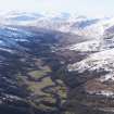
Murlagganmore


Head Dyke (Post Medieval), Township (Period Unassigned)
Site Name Murlagganmore
Classification Head Dyke (Post Medieval), Township (Period Unassigned)
Alternative Name(s) Murlaganbeg
Canmore ID 128285
Site Number NN53SW 7
NGR NN 5465 3460
NGR Description Centred NN 5465 3460
Datum OSGB36 - NGR
Permalink http://canmore.org.uk/site/128285

- Council Stirling
- Parish Killin
- Former Region Central
- Former District Stirling
- Former County Perthshire
Note
A township, comprising nine unroofed buildings, one enclosure and a head-dyke is depicted on the 1st edition of the OS 6-inch map (Perthshire 1867, sheet lxviii). Three unroofed buildings and the head-dyke are shown on the current edition of the OS 1:10000 map (1977).
Information from RCAHMS (AKK), 26 February 1998.

