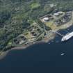
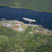
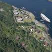
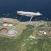
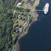
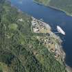
Finnart, Oil Terminal
Oil Pipeline Terminal (Modern), Pier(S) (Period Unassigned)
Site Name Finnart, Oil Terminal
Classification Oil Pipeline Terminal (Modern), Pier(S) (Period Unassigned)
Alternative Name(s) Loch Long; Finnart Ocean Terminal; Cnap Point
Canmore ID 128030
Site Number NS29NW 12
NGR NS 2400 9500
NGR Description Centred NS 2400 9500
Datum OSGB36 - NGR
Permalink http://canmore.org.uk/site/128030
- Council Argyll And Bute
- Parish Rhu
- Former Region Strathclyde
- Former District Dumbarton
- Former County Dunbartonshire
NS29NW 12.00 centred 2400 9500
Extends onto mapsheet NS29SW.
NS29NW 12.01 2386 9519 North pier
NS29NW 12.02 2368 9505 Central pier
For South pier (NS 2346 9463), see NS29SW 11.
For Ardarroch House (NS 2385 9503) and lodges (NS 2394 9501 and 2395 9495), see NS29NW 3 and NS29NW 4 and NS29SW 6; these buildings fall within the area of the terminal.
Oil Storage Depot [NAT]
OS 1:10,000 map, 1977.
Finnart Ocean Terminal
HO chart 3746, edition of 1990.


