Accessibility

Font Size

100% 150% 200%

Background Colour

Default Contrast
Close Reset

Antonine Wall, Croy Hill Roman Signal Platform (East)

Signal Platform (Roman)

Site Name Antonine Wall, Croy Hill Roman Signal Platform (East)

Classification Signal Platform (Roman)

Alternative Name(s) Croy Hill Expansion Roman Signal Platform (East)

Canmore ID 127412

Site Number NS77NW 16.02

NGR NS 7284 7623

Datum OSGB36 - NGR

Permalink http://canmore.org.uk/site/127412

Ordnance Survey licence number AC0000807262. All rights reserved.
Canmore Disclaimer. © Bluesky International Limited 2025. Public Sector Viewing Terms

Toggle Aerial | View on large map

Digital Images

Oblique aerial view.
Oblique aerial view.Oblique aerial view.Map 21 of 39 from Series V. Maps of the Antonine Wall and its known features at a scale of 1:5000 showing the scheduled areas and the proposed World Heritage Site. Maps were prepared for the nomination document to propose the extension of the Frontiers of the Roman Empire World Heritage Site through the addition of the Antonine Wall.Oblique aerial view.Map 5 of 8 from IV.I 1-8 - Series 1: Maps of the Antonine Wall at a scale of 1:25000 showing the proposed World Heritage Site, known forts and fortlets, camps, other features and the buffer zones. Maps were prepared for the nomination document to propose the extension of the Frontiers of the Roman Empire World Heritage Site through the addition of the Antonine Wall.Map showing the Antonine Wall, the World Heritage Site area, the areas of the World Heritage Site in public ownership or care, the Buffer Zone and the Council boundaries. Created for the World Heritage Site nomination - Management plan.Antonine Wall 1:25000 broadsheet map Oblique aerial view.Map 5 of 8 from IV.2 1-8 - Series 2: Maps of the Antonine Wall at a scale of 1:25000 showing the proposed World Heritage Site, known forts and fortlets, camps, other features and the buffer zones. Maps were prepared for the nomination document to propose the extension of the Frontiers of the Roman Empire World Heritage Site through the addition of the Antonine Wall.

Administrative Areas

  • Council North Lanarkshire
  • Parish Cumbernauld
  • Former Region Strathclyde
  • Former District Cumbernauld And Kilsyth
  • Former County Dunbartonshire

Archaeology Notes

Activities

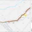
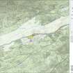
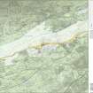
Publication Account (2008)

A 1:25000 scale map of the Antonine Wall was published by RCAHMS in 2008. The map shows the course of the Antonine Wall on a modern map base, including areas where the Wall is in public ownership or care and can be visited. The data had been collated as part of the project to prepare maps for the World Heritage Site nomination bid.

References

MyCanmore Image Contributions


Contribute an Image

MyCanmore Text Contributions