
Pricing Change
New pricing for orders of material from this site will come into place shortly. Charges for supply of digital images, digitisation on demand, prints and licensing will be altered.
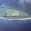
Kintradwell Farm


Farmstead (Period Unassigned)
Site Name Kintradwell Farm
Classification Farmstead (Period Unassigned)
Canmore ID 126505
Site Number NC90NW 41
NGR NC 9254 0780
NGR Description centred on 9254 0780
Datum OSGB36 - NGR
Permalink http://canmore.org.uk/site/126505

- Council Highland
- Parish Loth
- Former Region Highland
- Former District Sutherland
- Former County Sutherland
NC90NW 41 centred 9254 0780

