
Barra, Castlebay


Field System (Period Unassigned), Head Dyke (Post Medieval), Inn (Period Unassigned), School (Period Unassigned), Township (Period Unassigned)
Site Name Barra, Castlebay
Classification Field System (Period Unassigned), Head Dyke (Post Medieval), Inn (Period Unassigned), School (Period Unassigned), Township (Period Unassigned)
Alternative Name(s) Glenlots; Bagh A' Chaisteil; Bagh A' Chaisteil
Canmore ID 126127
Site Number NL69NE 63
NGR NL 671 985
NGR Description Centred NL 671 985
Datum OSGB36 - NGR
Permalink http://canmore.org.uk/site/126127


- Council Western Isles
- Parish Barra
- Former Region Western Isles Islands Area
- Former District Western Isles
- Former County Inverness-shire
Note
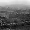
A township comprising sixty-seven roofed buildings, which include a school and an inn, four partially roofed buildings, eleven unroofed buildings, a field-system and a head-dyke is depicted on the 1st edition of the OS 6-inch map (Inverness-shire, Hebrides, Barra etc. 1880, sheet lxiv). This site is now located within the modern town of Castlebay.
Parts of the head-dyke and field-system are shown on the current edition of the OS 1:10000 map (1971).
Information from RCAHMS (SAH) 16 June 1997.

