
Druim Dubhram


Cairnfield (Period Unassigned), Hut Circle (Prehistoric)
Site Name Druim Dubhram
Classification Cairnfield (Period Unassigned), Hut Circle (Prehistoric)
Canmore ID 12487
Site Number NH46SE 1
NGR NH 4967 6074
Datum OSGB36 - NGR
Permalink http://canmore.org.uk/site/12487


- Council Highland
- Parish Fodderty
- Former Region Highland
- Former District Ross And Cromarty
- Former County Ross And Cromarty
NH46SE 1 4967 6074.
(NH 4967 6074) Enclosure (NR) (NH 4965 6085) Cairns (NR) (2 shown) (NH 4975 6089) Cairn (NR)
OS 1/10,000 map, (1970)
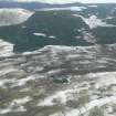
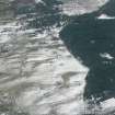
On a shelf on the generally S-facing whin-covered slopes of Drum Dubhran is a circular stone-walled hut measuring internally 11.3m in diameter, with a wall 2.3m thick. Inner and outer wall facing stones are evident intermittently. The 'simple' entrance, in the SE is flanked on its NE side by an earth-fast stone.
The hut occurs within an area of recent cultivation including rig and furrow but to the N of the hut are several denuded stone clearance heaps including those published as cairns on 0.S. 1/10,000 which are probably from contemporary cultivation plots.
Visited by OS (R L) 17 November 1970
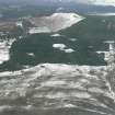
The hut circle is as described by the previous field investigator. The three mounds, published as cairns on 0S 1:10 000 1970 are probably associated stone clearance heaps similar to others about 300.0m to the NE (See NH56SW 5 ), but the northermost and the eastmost are prominently situated on the spine of a ridge, and are near circular, about 6.5m in diameter and 0.3m high, each surmounted by a modern cairn. The content of the NW mound is more "cairn-like". It measures 13.5m E-W by 10.5m N-S and 0.3m high; this is large for an early clearance heap, but the situation at the higher point of a steep N-facing slope would be unlikely for a burial cairn.
Published survey (25") revised.
Visited by OS (N K B) 20 December 1976
Field Visit (30 August 1943)
This site was included within the RCAHMS Emergency Survey (1942-3), an unpublished rescue project. Site descriptions, organised by county, vary from short notes to lengthy and full descriptions and are available to view online with contemporary sketches and photographs. The original typescripts, manuscripts, notebooks and photographs can also be consulted in the RCAHMS Search Room.
Information from RCAHMS (GFG) 10 December 2014.

