
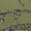
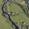
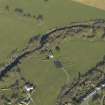
Contin, Manse, Stables


Farmstead (Period Unknown), Stable(S) (Period Unknown)
Site Name Contin, Manse, Stables
Classification Farmstead (Period Unknown), Stable(S) (Period Unknown)
Canmore ID 12448
Site Number NH45NE 50.01
NGR NH 45786 55609
NGR Description Centred NH 45786 55609
Datum OSGB36 - NGR
Permalink http://canmore.org.uk/site/12448


- Council Highland
- Parish Contin
- Former Region Highland
- Former District Ross And Cromarty
- Former County Ross And Cromarty
NH45NE 50.01 centred 45786 55609
Location formerly entered as NH 4578 5561.

