
Following the launch of trove.scot in February 2025 we are now planning the retiral of some of our webservices. Canmore will be switched off on 24th June 2025. Information about the closure can be found on the HES website: Retiral of HES web services | Historic Environment Scotland
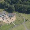
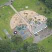
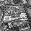
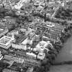
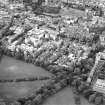
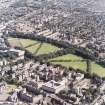
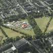
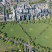
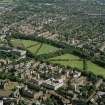
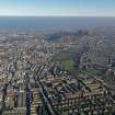
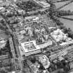
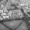
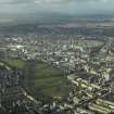
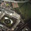
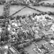
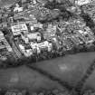
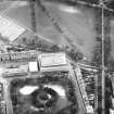
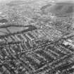
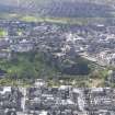
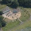
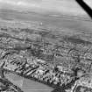
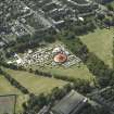
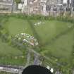
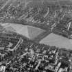
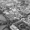
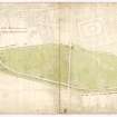
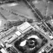
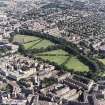
Edinburgh, The Meadows, General


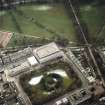
Public Park (18th Century)
Site Name Edinburgh, The Meadows, General
Classification Public Park (18th Century)
Alternative Name(s) Straiton's Park; Hope Park; Meadow Walk; East Meadow Park; West Meadow Park
Canmore ID 124100
Site Number NT27SE 1983
NGR NT 25671 72629
Datum OSGB36 - NGR
Permalink http://canmore.org.uk/site/124100


- Council Edinburgh, City Of
- Parish Edinburgh (Edinburgh, City Of)
- Former Region Lothian
- Former District City Of Edinburgh
- Former County Midlothian
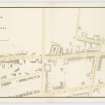
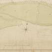
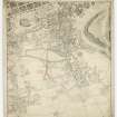
The decision to drain the South Loch was made in 1657, but was not successfully achieved until 200 years later. For NMRS archive relating to the Meadows site before drainage, see:
NT27SE 2170 Edinburgh, Borough-Loch
REFERENCE:
SCOTTISH RECORD OFFICE
Mention of Edinburgh improvements.
'Mr Hope has beautified the meadow wonderfully and made it another St James's Park'.
Letter from [*Alexander Bayne] to William Murray.
N.D.
GD 189/2/164
[*Thomas Hope of Rankeillor ]
NMRS LIBRARY
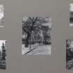
Historical File - "Meadows West, Commemorative Pillars"
Sketch
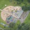
- "Meadows West, Sundial"
Measured sketch
See also:
NT27SE 1983.01 Edinburgh, The Meadows, Sundial
1983.02 Edinburgh, The Meadows (West), Mason's Pillars
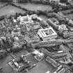
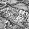
1983.03 Edinburgh, The Meadows, Edinburgh International Exhibition 1886 1983.04 Edinburgh, The Meadows (East), Pillars
1983.05 Edinburgh, Middle Meadow Walk, Pillars
1983.06 Edinburgh, Middle Meadow Walk

