
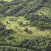
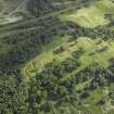
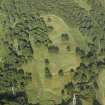
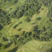
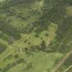
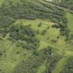
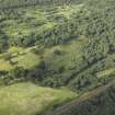
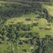
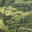
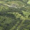
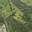
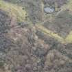
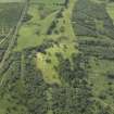
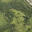
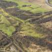
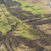
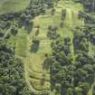
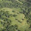
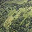
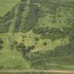
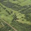
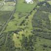
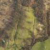
Antonine Wall, Rough Castle


Frontier Defence (Roman)
Site Name Antonine Wall, Rough Castle
Classification Frontier Defence (Roman)
Canmore ID 124018
Site Number NS88SW 57
NGR NS 8474 8003
NGR Description NS 8464 8000 to NS 8490 8000
Datum OSGB36 - NGR
Permalink http://canmore.org.uk/site/124018


- Council Falkirk
- Parish Falkirk
- Former Region Central
- Former District Falkirk
- Former County Stirlingshire
NS88SW 57 8464 8000 to 8490 8000
See also NS87NW 6 and NS87NW 32.00 .
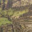
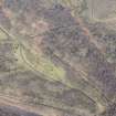
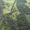
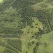
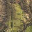
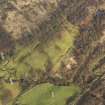
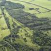
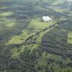
NS 8464 8000 to NS 8490 8000 Published course (OS 25 inch 1961) resurveyed. Wall, Ditch and Outer Mound are fairly well defined, although the sharp alignment angle can now only be deduced from the projected extant straights. Extant dimensions vary, but on the W the Rampart averages 1.5m high and the Ditch, 12m wide and 1.2m deep.
NS 8464 8000 Rampart, Ditch and Outer Mound sectioned in 1959 (Robertson 1963-4).
Information from OS 1980
A S Robertson 1963-4.
Excavation (September 1959)
NS 8464 8000 Rampart, Ditch and Outer Mound sectioned in 1959 (Robertson 1963-4).
A S Robertson 1963-4.
Field Visit (1980)
NS 8464 8000 to NS 8490 8000 Published course (OS 25 inch 1961) resurveyed. Wall, Ditch and Outer Mound are fairly well defined, although the sharp alignment angle can now only be deduced from the projected extant straights. Extant dimensions vary, but on the W the Rampart averages 1.5m high and the Ditch, 12m wide and 1.2m deep.
Information from OS 1980

