Cullykhan Shore, Old Quay
Quay (Period Unknown)
Site Name Cullykhan Shore, Old Quay
Classification Quay (Period Unknown)
Alternative Name(s) Troup; Castle Point; Cullykhan Bay
Canmore ID 123976
Site Number NJ86NW 15
NGR NJ 8379 6613
Datum OSGB36 - NGR
Permalink http://canmore.org.uk/site/123976
- Council Aberdeenshire
- Parish Gamrie
- Former Region Grampian
- Former District Banff And Buchan
- Former County Banffshire
NJ86NW 15 8379 6613
Old Quay [NAT]
OS 1:10,000 map, 1971.
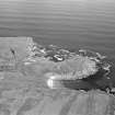
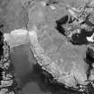
Air photography (AAS/97/12/G26/7, flown 9 October 1997) has recorded the wave-eroded and badly-collapsed remains of an old quay (built of red sandstone blocks) on the S-facing side of Cullykhan Shore.
NMRS, MS/712/26.
Field Visit (May 2022)
NJ 83790 66130 Visited during fieldwork by SCAPE. Quay is as described. Possibly a landing place related to the castle.
Information from S Boyd and J Hambly - Scottish Coastal Archaeology and the Problem of Erosion (SCAPE)


