
North Uist, Carinish


Church (Period Unassigned), Township (Period Unassigned)
Site Name North Uist, Carinish
Classification Church (Period Unassigned), Township (Period Unassigned)
Canmore ID 123316
Site Number NF86SW 57
NGR NF 818 603
NGR Description Centred NF 818 603
Datum OSGB36 - NGR
Permalink http://canmore.org.uk/site/123316


- Council Western Isles
- Parish North Uist
- Former Region Western Isles Islands Area
- Former District Western Isles
- Former County Inverness-shire
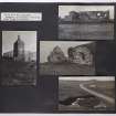
Photographic Record (1906)
Photographs taken during a visit by the Churches Commission in July 1906.
The photographs are available in PA 71.
Note
A township comprising five roofed buildings, one of which is annotated as a Church, three partially roofed buildings, seven unroofed buildings, three enclosures and some field walls is depicted on the 1st edition of the OS 6-inch map (Inverness-shire, Hebrides, North Uist 1882, sheet xxxix). Five roofed, two partially roofed, seven unroofed buildings, two enclosures and some field walls are shown on the current edition of the OS 1:10000 map (1971).
Information from RCAHMS (SAH) 30 April 1997.

