Forth Defences, Outer, Inchkeith, "h" Group, Later "l"group,two 6-inch Gun Emplacements
Coastal Battery (19th Century) - (20th Century), Coastal Battery (Second World War), Coastal Battery (First World War)
Site Name Forth Defences, Outer, Inchkeith, "h" Group, Later "l"group,two 6-inch Gun Emplacements
Classification Coastal Battery (19th Century) - (20th Century), Coastal Battery (Second World War), Coastal Battery (First World War)
Alternative Name(s) Fort No.1
Canmore ID 122974
Site Number NT28SE 5.07
NGR NT 29113 82874
Datum OSGB36 - NGR
Permalink http://canmore.org.uk/site/122974
- Council Fife
- Parish Kinghorn
- Former Region Fife
- Former District Kirkcaldy
- Former County Fife
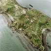
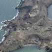
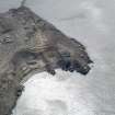
The battery at first known as “H” Group and later re-named “L” was built on the site of the Victorian period “Fort No. 1” on the westernmost part of the island. In 1879 one of four 10-inch Rifled Muzzle Loader guns on the island had been emplaced here. According to the Fort Record Book the gun was replaced by a single 6-inch gun in 1891, the 10-inch gun being sent to Kinghorn.
The Fort Record Book is silent on the history of the single 6-inch gun here between 1891 and 1914; the other four 6-inch guns (in groups “A” and “M”) had been removed in 1909 and the gun in “H” Group was not listed as being part of the approved armament of the island on the outbreak of war.
Drawings on a War Office file (The National Archives WO 78/5180) show proposals dated August 1916 for the addition of a second 6-inch gun emplacement, to the north of the existing one, while the existing emplacement was being rebuilt. The whole of “H” Group (comprising three 6-inch guns at this point – ‘O’ group being part of ‘H’ group at this time) was noted as being equipped with two Defence Electric Lights which War Office drawings show as being close to the “advanced” emplacement. [The National Archives WO 78/5180] (see NT28SE 5.41).
Confusingly, what had hitherto been “H” Group, with three 6-inch guns, had been re-named “L” and “O” Groups by February 1918 - the two-gun battery being “L” and the single “Advanced” position gun as “O” (see NT28SE 5.04).
The battery command post was a tall structure with a cupola, resembling a lighthouse, the elevation and cross-section being illustrated on a War Office drawing on file (The National Archives WO 78/5180), dated June 1916.
On a 1941 map of the island the two guns of the main “H” Group battery are labelled “West Gun No. 1” and “West Gun No. 2”.
Information from HS/RCAHMS World War One Audit Project (GJB) 30 October 2013.
NT28SE 5.07 29113 82874
For Victorian perion gun battery remains see NT28SE 1.01
Situated on the NW side of the island, and part of Fort No.1, this battery is annotated on WO plan as West Nos. 1 and 2 guns but no gun calibre is given. A 3" anti-aircraft gun emplacement is shown between the two coast battery positions (NT28SE 5.11).
Information from RCAHMS (DE) November 1997.
A double emplacement 20th century gun battery is situated on the W side of the Island and N of the Harbour (NT28SE 12). The battery is built over the underground remains of the Victorian Fort No.1 (NT28SE 1.01).
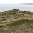
The battery consists of two brick and concrete gun emplacements, that to the N being West gun No.1, whilst that accessed directly through the Victorian period building is West gun No.2. There are detail differences between the two emplacements, No.2 gun being accessed from the rear of the gun pit via stairs through the Victorian magazines. No.1 gun is accessed through a deep brick lined entranceway leading to a small courtyard with a crew shelter on the W side and then by a flight of concrete steps to the SW side. Both emplacements are built of brick and concrete and are circular with the characteristic groove half way up the gun pit. Ready use ammunition lockers are found at the rear of the gun pit. In both emplacements the ring of bolts forming the holdfast was noted in the vegetation growth of the floors.
The brick and concrete Battery Observation Post is a tower of four storeys, one at basement level with a distinctive viewing platform at the top. The rear wall (E side) is built over the main stone wall of Victorian Fort No.1. The top viewing platform which faces W has a semi circular balcony/extension at the S end.. Access to all floors is on the S side via a steel staircase which is now in a very dangerous condition.
Internally only the ground floor room were viewed, one of which has been painted in a blue colour, most probably by recent occupants of the Island.
Visited by RCAHMS (DE, AL, JM), 25 February, 4 and 5th March 2009
Project (March 2013 - September 2013)
A project to characterise the quantity and quality of the Scottish resource of known surviving remains of the First World War. Carried out in partnership between Historic Scotland and RCAHMS.


