Forth Defences, Outer, Inchkeith, B Group, 9.2-inch Emplacement
Coastal Battery (19th Century) - (20th Century), Coastal Battery (Second World War), Coastal Battery (First World War)
Site Name Forth Defences, Outer, Inchkeith, B Group, 9.2-inch Emplacement
Classification Coastal Battery (19th Century) - (20th Century), Coastal Battery (Second World War), Coastal Battery (First World War)
Alternative Name(s) South Battery
Canmore ID 122973
Site Number NT28SE 5.06
NGR NT 29474 82471
Datum OSGB36 - NGR
Permalink http://canmore.org.uk/site/122973
- Council Fife
- Parish Kinghorn
- Former Region Fife
- Former District Kirkcaldy
- Former County Fife
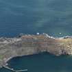
Three 9.2-inch guns formed the main armament of Inchkeith. This calibre of gun was intended to tackle the largest enemy ships that might attack the British coast. The guns were mounted in separate emplacements set along the high central ridge of the island: that known as “B” Group was the southernmost.
“B” Group was the first 9.2-inch gun emplaced on the island, in 1892. The original Mk 1 gun was replaced by a Mk X (the same type mounted in Groups “F” and “L”) in 1905-6.
By 1941 the name of the gun had been changed to South 9.2”gun.
A brick and concrete canopy was added before or in the early years of the Second World War.
Information from HS/RCAHMS World War One Audit Project (GJB) 1 November 2013.
NT28SE 5.06 29474 82471
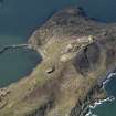
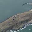
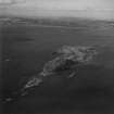
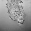
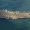
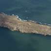
Situated on the spine of the island and annotated as part of B group south on the WO plan ((PRO 192/251), this battery mounted a 9.2" gun during WWII. 50m to the SE is an emplacement for a 3" anti-aircraft gun (NT28SE 5.10), the position is visible on an oblique aerial photograph taken in 1941 (RAF S309, 6962, flown October 1941)
Information from RCAHMS (DE) November 1997.
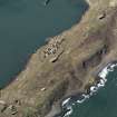
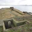
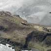
A single emplacement for a 9.2-inch gun is situated on a level section of the ridge on the S half of the Island . The emplacement consists of a concrete gun pit, brick and concrete canopy all set over extensive underground magazines, offices and rooms.
The below ground installation is entered from the NNW by a deep rock trench which is lined with concrete. At the S end of the trench closest to the emplacement is a suit of rooms accessed at a lower level by a flight of stairs. The rooms lead to the magazines are accessed through brick lined corridors and half-way along the main access is a shell hoist for the large calibre ammunition.
Within the gun pit are several ready-use ammunition lockers and a moveable 'bridge', now collapsed, which provides access to the rear of the gun emplacement. A series of large metal rings are set around the wall of the gun pit, installed to assist in the servicing of the guns allowing them to be jack hoisted into position using the rings to provide stablising points.
A vertical shaft with a metal ladder from the NE quadrant of the gun pit provides another access point to the magazines and a wooden cover for the shaft lies in situ beside the top of this shaft.
To the N of the emplacement at NT 29466 82513 is a sunken concrete lined semi circular structure providing a second vertical access to the underground installations.
The emplacement when built was likely to have been an open mounting with no canopy and it is likely that the brick and concrete canopy with steel supporting beams was added either immediately before World War II or in late 1939-early 1940. The gun emplacement is annotated as 'F Group' on the War Office plan of the Island (copy held in RCAHMS under MS 879/83).
Visited by RCAHMS (DE, AL, JM), 25 February, 3 and 5th March 2009
Archaeological Evaluation (August 2007)
Sea & Land Power and Energy Ltd. commissioned Headland Archaeology Ltd to undertake an archaeological survey and assessment of an area for a proposed temporary anemometer mast and anchor points at the south end of Inchkeith Island in the Firth of Forth. As Inchkeith is a Scheduled Ancient Monument (SAM 3838), Scheduled Monument Consent is required for the installation of the anemometer from Historic Scotland, acting
on behalf of the Scottish Ministers. The assessment identified thirteen structures and four areas of archaeological interest that lie within the assessment area, which formed an area approximately 90m by 60m or 5400m². The survey succeeded in plotting these structures and features within a general topographic survey in relation to the proposed location of the mast plate and 5 anchor points. These locations were assessed as to the level of potential impacts that their introduction may have on archaeological features. This has resulted in a minor modification of
the proposed location in order to minimize any impacts.
Project (March 2013 - September 2013)
A project to characterise the quantity and quality of the Scottish resource of known surviving remains of the First World War. Carried out in partnership between Historic Scotland and RCAHMS.


