
Harris, Lechcan


Head Dyke (Post Medieval), Township (Period Unassigned)
Site Name Harris, Lechcan
Classification Head Dyke (Post Medieval), Township (Period Unassigned)
Canmore ID 122294
Site Number NB10SW 12
NGR NB 135 015
NGR Description centred on NB 135 015
Datum OSGB36 - NGR
Permalink http://canmore.org.uk/site/122294


- Council Western Isles
- Parish Harris
- Former Region Western Isles Islands Area
- Former District Western Isles
- Former County Inverness-shire
Note
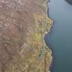
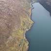
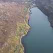
A township comprising one unroofed, four roofed buildings and a head-dyke is depicted on the 1st edition of the OS 6-inch map (Inverness-shire, Island of Harris 1882, sheet xiii). The head-dyke is joined to that of the township of West Tarbert (NB10SW 13) to the SE and to that of the farmstead of Caolas-na-sgeir (NB10SW 11) to the NW.
One unroofed, seven roofed buildings, four enclosures, some field walls and a head-dyke are shown on the current edition of the OS 1:10000 map (1973).
Information from RCAHMS (SAH) 24 February 1997

