|
Manuscripts |
MS 810/5 |
Records of Historic Scotland, Edinburgh, Scotland |
Lothian Region - A survey of 20th Century Defences in the Lothian region. A survey by John Guy. |
1997 |
Item Level |
|
|
Manuscripts |
MS 879/33 |
|
Letter from Ian Brown dated 11 November 1998 enclosing copies of typed lists and maps showing locations of wartime and post-war radar and radio navigation aids sites in Scotland. |
11/11/1998 |
Item Level |
|
 |
On-line Digital Images |
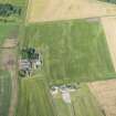
DP 216669 |
RCAHMS Aerial Photography Digital |
Oblique aerial view of the cropmarks of the field boundaries, looking W. |
9/7/2015 |
Item Level |
|
 |
On-line Digital Images |
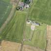
DP 216670 |
RCAHMS Aerial Photography Digital |
Oblique aerial view of the cropmarks of the field boundaries, looking WSW. |
9/7/2015 |
Item Level |
|
 |
On-line Digital Images |
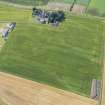
DP 216671 |
RCAHMS Aerial Photography Digital |
Oblique aerial view of the cropmarks of the field boundaries, looking SSE. |
9/7/2015 |
Item Level |
|
 |
On-line Digital Images |
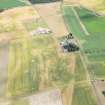
DP 284314 |
Historic Environment Scotland |
Oblique aerial view. |
17/7/2018 |
Item Level |
|
 |
Digital Files (Non-image) |
WP 007685 |
Records from Headland Archaeology Ltd, archaeologists, Edinburgh, Scotland |
Report: 'The Radar Station, Dirleton, East Lothian: Building Survey', October 2001 |
10/2001 |
Item Level |
|
|
Digital Files (Non-image) |
GV 008766 |
Records from Headland Archaeology Ltd, archaeologists, Edinburgh, Scotland |
Vector graphic report figure 2: 'Site plan showing the location of surveyed features', Building survey, The Radar Station, Dirleton, East Lothian |
9/8/2001 |
Item Level |
|
|
Digital Files (Non-image) |
GV 008767 |
Records from Headland Archaeology Ltd, archaeologists, Edinburgh, Scotland |
Vector graphic report figure 3: 'Plan of roof and ground floor of main operation and domestic accommodation', Building survey, The Radar Station, Dirleton, East Lothian |
20/8/2001 |
Item Level |
|
|
Digital Files (Non-image) |
GV 008768 |
Records from Headland Archaeology Ltd, archaeologists, Edinburgh, Scotland |
Vector graphic report figure 4: 'External elevations of the operations and domestic block', Building survey, The Radar Station, Dirleton, East Lothian |
2/10/2001 |
Item Level |
|
|
Digital Files (Non-image) |
GV 008769 |
Records from Headland Archaeology Ltd, archaeologists, Edinburgh, Scotland |
Vector graphic report figure 5: 'Internal elevations of the operations room', Building survey, The Radar Station, Dirleton, East Lothian |
2/10/2001 |
Item Level |
|
|
Digital Files (Non-image) |
GV 008770 |
Records from Headland Archaeology Ltd, archaeologists, Edinburgh, Scotland |
Vector graphic report figure 6: 'Plan and external elevations of the generator house', Building survey, The Radar Station, Dirleton, East Lothian |
6/9/2001 |
Item Level |
|
|
Digital Files (Non-image) |
GV 008771 |
Records from Headland Archaeology Ltd, archaeologists, Edinburgh, Scotland |
Vector graphic report figure 7: 'Plan and external elevations of the sewage / pumphouse', Building survey, The Radar Station, Dirleton, East Lothian |
2/9/2001 |
Item Level |
|
|
Digital Files (Non-image) |
GV 008772 |
Records from Headland Archaeology Ltd, archaeologists, Edinburgh, Scotland |
Vector graphic report figure 8: 'Plan and elevation of the IFF cubicle', Building survey, The Radar Station, Dirleton, East Lothian |
2/10/2001 |
Item Level |
|
|
Digital Files (Non-image) |
GV 008773 |
Records from Headland Archaeology Ltd, archaeologists, Edinburgh, Scotland |
Vector graphic report figure 9: 'Plan and elevations of the PPI aerial stance', Building survey, The Radar Station, Dirleton, East Lothian |
2/10/2001 |
Item Level |
|
 |
On-line Digital Images |
SC 2200476 |
Records from Headland Archaeology Ltd, archaeologists, Edinburgh, Scotland |
Building survey, Scanned photograph of the domestic accommodation from the S, The Radar Station, Dirleton, East Lothian |
c. 8/2001 |
Item Level |
|
 |
On-line Digital Images |
SC 2200477 |
Records from Headland Archaeology Ltd, archaeologists, Edinburgh, Scotland |
Building survey, Scanned photograph of the domestic accommodation from the E, The Radar Station, Dirleton, East Lothian |
c. 8/2001 |
Item Level |
|
 |
On-line Digital Images |
SC 2200478 |
Records from Headland Archaeology Ltd, archaeologists, Edinburgh, Scotland |
Building survey, Scanned photograph of the S end of the operations block from the W, The Radar Station, Dirleton, East Lothian |
c. 8/2001 |
Item Level |
|
 |
On-line Digital Images |
SC 2200479 |
Records from Headland Archaeology Ltd, archaeologists, Edinburgh, Scotland |
Building survey, Scanned photograph of the operations block and domestic accommodation from the NW, The Radar Station, Dirleton, East Lothian |
c. 8/2001 |
Item Level |
|
 |
On-line Digital Images |
SC 2200480 |
Records from Headland Archaeology Ltd, archaeologists, Edinburgh, Scotland |
Building survey, Scanned photograph of the operations block from the NE, The Radar Station, Dirleton, East Lothian |
c. 8/2001 |
Item Level |
|
 |
On-line Digital Images |
SC 2200481 |
Records from Headland Archaeology Ltd, archaeologists, Edinburgh, Scotland |
Building survey, Scanned photograph of the operations block from the SE, The Radar Station, Dirleton, East Lothian |
c. 8/2001 |
Item Level |
|
 |
On-line Digital Images |
SC 2200482 |
Records from Headland Archaeology Ltd, archaeologists, Edinburgh, Scotland |
Building survey, Scanned photograph of the N end of the operations block from the W, The Radar Station, Dirleton, East Lothian |
c. 8/2001 |
Item Level |
|
 |
On-line Digital Images |
SC 2200483 |
Records from Headland Archaeology Ltd, archaeologists, Edinburgh, Scotland |
Building survey, Scanned photograph of the NW corner of the operations block from the W, The Radar Station, Dirleton, East Lothian |
c. 8/2001 |
Item Level |
|
|
Photographs and Off-line Digital Images |
SC 2200484 |
Records from Headland Archaeology Ltd, archaeologists, Edinburgh, Scotland |
Building survey, Scanned photograph of the technical officer's room, The Radar Station, Dirleton, East Lothian |
c. 8/2001 |
Item Level |
|