
Pricing Change
New pricing for orders of material from this site will come into place shortly. Charges for supply of digital images, digitisation on demand, prints and licensing will be altered.
Carnoch


Broch (Iron Age)(Possible), Galleried Dun (Iron Age)
Site Name Carnoch
Classification Broch (Iron Age)(Possible), Galleried Dun (Iron Age)
Canmore ID 12179
Site Number NH25SE 4
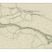
NGR NH 25071 50772
Datum OSGB36 - NGR
Permalink http://canmore.org.uk/site/12179


- Council Highland
- Parish Urray (Ross And Cromarty)
- Former Region Highland
- Former District Ross And Cromarty
- Former County Ross And Cromarty
NH25SE 4 252 507.
"The remains of an old Druid circle" lie about half a mile E of the crannog in Loch Beannocharain (NH25SW 4). "The farmer's son at Carnoch (NH 2550) dug inside the circle seven or eight years ago, and found a brass ring, now in his possesion.
F O Blundell 1913
Not located.
Visited by OS (N K B) 24 October 1966
NH 252 507: Galleried Dun, Carnoch. A walled oval enclosure on a glacial mound, measuring some 20 m E-W by 16 m N-S. The wall is about 4 m thick, thickening to N where there are traces of side chambers on either side of the entrance. It has been much jumbled by 19th century excavations; the finds are locally believed to have been sent to the National Museum of Antiquities of Scotland, but the latter have been unable to trace them.
Information from P J Ashmore to OS 25 August 1976
Publication Account (2007)
NH25 1 CARNOCH
NH/252507
This oval probable broch or 'galleried dun' in Urray, Ross and Cromarty, consists of a "walled oval enclosure on a glacial mound, measuring some 20m E-W by 16m N-S. The wall is about 4m thick and, thickening to the N where there are traces of side chambers on either side of the entrance. It has been much jumbled by 19th century excavations; the finds are locally believed to have been sent to the National Museum of Antiquities of Scotland but the latter have (sic) been unable to trace them" [1].
Sources: 1. NMRS site no. NH 25 SE 4: 2. Blundell 1913, 280.
E W MacKie 2007
Srp Note (24 January 2011)
A possible galleried dun (NOSAS site survey number 627) is located on the N side of the River Meig, some 200m SW of Carnoch Farm. It utilises a knoll on the river terrace that forms a steep bank above the river. It is a sub circular in plan with an overall diameter of c24m with stony banks up to 1m high in places. The bank is stony in several places, roughly 7-9m in width and surrounds a dished centre with internal diameter of c7m. The bank is 1m in height in the NW and SE parts but otherwise low. It has several stony pits; it has possibly been quarried for its stone or excavated previously by curious parties. It has been suggested that the pits are possible galleries.
Further details of these and other associated sites can be found in the Strathconon Phase 4 Report (page36) produced by the North of Scotland Archaeology Society and appended to this record.

