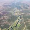
An Abait, Dalchreichart
Boundary Marker(S) (Period Unassigned), Sanctuary (Medieval)
Site Name An Abait, Dalchreichart
Classification Boundary Marker(S) (Period Unassigned), Sanctuary (Medieval)
Canmore ID 12158
Site Number NH21SE 2
NGR NH 286 127
NGR Description NH c. 286 127
Datum OSGB36 - NGR
Permalink http://canmore.org.uk/site/12158
- Council Highland
- Parish Urquhart And Glenmoriston
- Former Region Highland
- Former District Inverness
- Former County Inverness-shire
NH21SE 2 c. 286 127
Area: NH 286 127 The great sanctuary in the parish was at An Abait - The Abbey - lying between Ballintombuy (NH 2813) and Dulchriechard (2912) in Glenmoriston. The Abbey consisted of an island in the small tarn of Lochan-a' Chrois - the Lochlet of the Cross - and the surrounding land extending from Tomchraskie (NH 25 12) to Tomnacroich and from Mam-a'-Chrois (NH 26 07) to Ruigh- a'Chrois - bounds said to have been indicated at one time by crosses. The district was probably the 'Kirk Lands' of Glenmoriston, mentioned in 1572. According to tradition, the Abbey was respected as a sanctuary until a comparatively recent period. The right of sanctuary prevailed probably until the 14th century, when feudal baron courts were established.
W MacKay 1914.
According to Mr. MacTavish, (Mr A MacTavish, Balintombuie, Glenmoriston) there is a tradition that a cross once stood on Lochan a'Chrois. No traces of the other crosses, which are said to have defined the limits of the sanctuary, could be found.
Visited by OS (N K B), 1 June 1964.


