
Leckmelm


Broch (Iron Age)(Possible)
Site Name Leckmelm
Classification Broch (Iron Age)(Possible)
Alternative Name(s) Allt Raon A' Chroisg
Canmore ID 12135
Site Number NH19SE 1
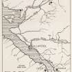
NGR NH 1695 9008
Datum OSGB36 - NGR
Permalink http://canmore.org.uk/site/12135


- Council Highland
- Parish Lochbroom
- Former Region Highland
- Former District Ross And Cromarty
- Former County Ross And Cromarty
NH19SE 1 1695 9008
(NH 1695 9008) Pitish Tower (OE) (Remains of).
OS 6" map, Ross-shire, 2nd ed., (1906)
The foundation of a circular mound or old wall about 30 feet in diameter, on the north bank of Allt Raon a'Chroisg about 5 chains above the Ullapool Road, is stated by A G Pirie Esq., proprietor of the Leckmeln Estate, to be known locally and traditionally as the remains of a Pictish Tower. Lt Col T P White who signed this note, (1886) taken from the survey trace, could not trace any descriptive name for it.
OS Name Book 1875; D Macdonald, A Polson and J Brown 1931.
Calder and Steer could find no trace of a 'Pictish Tower' (? broch) and the oldest local inhabitant had never heard of its existence. Visited October 1947.
C S T Calder and K A Steer 1948-9.
At the published site there is a grass-and-heather- covered knoll, bordered on two sides by a steep ravine. Many loose rubble stones litter the hillock, suggesting some kind of previous construction, but there is nothing to indicate a broch. The knoll is not circular now, but it appears to have been quarried on the north side.
Visited by OS (N K B), 6 October 1964
No change to previous report
Visited by OS (N K B), 25 September 1970.
Measured Survey (October 1947)
Following the report of an unrecorded vitrified fort at Dun Lagaidh, Ullapool, in October 1947 Kenneth Steer and Charles Calder, RCAHMS, surveyed the site, together with a number of monuments in the vicinity.
Source: C S T Calder and K A Steer 1951
Publication Account (2007)
NH19 1 ALLT RAON A' CHROISG ('Leckmelm')
NH/1695 9008
Possible broch in Lochbroom, Ross and Cromarty, described as a 'Pictish tower' on the 1906 OS 6-inch map [1], and in 1875 apparently visible as the foundations of a circular mound or wall about 30ft in diameter [1]. Nothing can be seen now [3] except a rubbly knoll which does not look very like a broch site [1].
Sources: 1. NMRS site no. NH 19 SE 1: 2. Macdonald and Polson 1931, 75: 3. Calder and Steer, 1949, 76.
E W MacKie 2007

