
Ordachoy


Farmhouse (Period Unassigned), Farmstead (Period Unassigned), Horse Engine Platform (Post Medieval)
Site Name Ordachoy
Classification Farmhouse (Period Unassigned), Farmstead (Period Unassigned), Horse Engine Platform (Post Medieval)
Canmore ID 121320
Site Number NJ20NE 89
NGR NJ 2795 0773
Datum OSGB36 - NGR
Permalink http://canmore.org.uk/site/121320


- Council Aberdeenshire
- Parish Strathdon
- Former Region Grampian
- Former District Gordon
- Former County Aberdeenshire
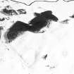
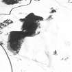
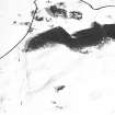
The farmsteading of Ordachoy is located approximately 250m west of the River Don, south of Corgarff. Probably built between the mid-eighteenth and nineteenth centuries, it comprises a farmhouse, L-plan steading and some smaller outbuildings. Traces of a circular horse-engine platform are visible at the end of the steading.
This farmsteading dates from the period of agricultural improvements, when huge changes took place throughout Scotland. Buildings of this date reflect the more organised approach to farming taken by landowners from this time.
Text prepared by RCAHMS as part of the Accessing Scotland's Past project
NJ20NE 89 2795 0773
The cottage and steading at Ordachoy are still in use. There is a horse-engine platform immediately SW of the steading.
Visited by RCAHMS (SPH), 16 March 1998.
Standing Building Recording (13 March 2019 - 10 June 2019)
NJ 2793 0772 A programme of archaeological works was undertaken at Ordachoy, Corgarff during March to June 2019.
A small L-plan farmstead consisted of a byre with a loft over one end and a small mill and barn. The platform of a horse mill remained and was sectioned and recorded during the watching brief. This revealed the stone-lined channel for the drive shaft.
A small freestanding building with a hearth in the surviving stone gable, lay beside the stack yard and is shown on the 1867 and 1901 OS maps. It may have been a bothy or possibly a wash-house/laundry or even some form of corn drying kiln. However, its position near the stack yard enclosure and its E-W orientation may identify it as also having functioned as a ‘secret’ Roman Catholic meeting place reported by oral tradition to have been near the corn yard in the late 18th/ early 19th century.
Archive: Aberdeenshire HER and NRHE
Funder: Dunecht Estates
H K Murray ̶ Murray Archaeological Services Ltd
(Source: DES Vol 20)
OASIS ID: mas1-372010
Watching Brief (13 March 2019 - 10 June 2019)
NJ 2793 0772 A programme of archaeological works was undertaken at Ordachoy, Corgarff during March to June 2019.
A small L-plan farmstead consisted of a byre with a loft over one end and a small mill and barn. The platform of a horse mill remained and was sectioned and recorded during the watching brief. This revealed the stone-lined channel for the drive shaft.
Archive: Aberdeenshire HER and NRHE
Funder: Dunecht Estates
H K Murray ̶ Murray Archaeological Services Ltd
(Source: DES Vol 20)
OASIS ID: mas1-372010

