
Edinburgh, 144 Cowgate


Nursery School (Period Unassigned)
Site Name Edinburgh, 144 Cowgate
Classification Nursery School (Period Unassigned)
Alternative Name(s) Borthwick's Close; Cowgate Nursery School
Canmore ID 120903
Site Number NT27SE 1709
NGR NT 25856 73492
Datum OSGB36 - NGR
Permalink http://canmore.org.uk/site/120903


![Post-ex shot of drain [020]](http://i.rcahms.gov.uk/canmore/l/DP00288144.jpg)
![Pre-ex shot of paving (030), clay (031) and wall [016]](http://i.rcahms.gov.uk/canmore/l/DP00288145.jpg)
![Slabs (039) exposed after removal of S end of wall [016]](http://i.rcahms.gov.uk/canmore/l/DP00288157.jpg)


![Stake holes [073] in N-S row without marker](http://i.rcahms.gov.uk/canmore/l/DP00288177.jpg)
![View of walls [043] and [023] with deposit (054) shown](http://i.rcahms.gov.uk/canmore/l/DP00288179.jpg)
![View of walls [043] and [023] with deposit (054) shown](http://i.rcahms.gov.uk/canmore/l/DP00288181.jpg)
![East elevation of wall [047], N end](http://i.rcahms.gov.uk/canmore/l/DP00288190.jpg)
![N facing elevation of wall [066], east end](http://i.rcahms.gov.uk/canmore/l/DP00288203.jpg)
![N facing elevation of wall [066], west end](http://i.rcahms.gov.uk/canmore/l/DP00288204.jpg)
![W facing elevation of wall [022], N end](http://i.rcahms.gov.uk/canmore/l/DP00288205.jpg)
![S facing elevation of blocking [046], wall [048] and E end of wall [044]](http://i.rcahms.gov.uk/canmore/l/DP00288211.jpg)
![S facing elevation of blocking [046], and walls [024], [048] and [044]](http://i.rcahms.gov.uk/canmore/l/DP00288214.jpg)


![W facing elevation of wall [022], S end](http://i.rcahms.gov.uk/canmore/l/DP00288234.jpg)
![Section across walls [103] and [066]](http://i.rcahms.gov.uk/canmore/l/DP00288238.jpg)
![Wall [024] fully exposed](http://i.rcahms.gov.uk/canmore/l/DP00288260.jpg)


![Doorway with wooden threshold and frame between walls [044] and [048]](http://i.rcahms.gov.uk/canmore/l/DP00288274.jpg)
![Area B with pit [173] and deposits (174), (175), (176) & (177)](http://i.rcahms.gov.uk/canmore/l/DP00288280.jpg)
![Line of uprights [180] inside wall [066]](http://i.rcahms.gov.uk/canmore/l/DP00288289.jpg)
![Drain [124] along W side of wall [022]](http://i.rcahms.gov.uk/canmore/l/DP00288292.jpg)

![Post-ex shot of drain [181] running under wall [024]](http://i.rcahms.gov.uk/canmore/l/DP00288297.jpg)
![S facing elevation of wall [044], E end](http://i.rcahms.gov.uk/canmore/l/DP00288310.jpg)
![E facing elevation of wall [139], south of #242](http://i.rcahms.gov.uk/canmore/l/DP00288314.jpg)
![Rubble (225) over wall [210]](http://i.rcahms.gov.uk/canmore/l/DP00288340.jpg)

![Wall [210], east of # 275](http://i.rcahms.gov.uk/canmore/l/DP00288346.jpg)
![Wall [210], east of # 286](http://i.rcahms.gov.uk/canmore/l/DP00288357.jpg)


![S facing section of Hpit 9, south of wall [210]](http://i.rcahms.gov.uk/canmore/l/DP00288434.jpg)
![S facing section of Hpit 9, north of wall [210]](http://i.rcahms.gov.uk/canmore/l/DP00288435.jpg)


![View of wall [024]/[044]/[045]/[048]/[046] and abutting wall [047]](http://i.rcahms.gov.uk/canmore/l/DP00288154.jpg)
![East elevation of wall [047], S end](http://i.rcahms.gov.uk/canmore/l/DP00288187.jpg)
![Pre-ex shot of collection stake holes and wooden posts [073] with markers](http://i.rcahms.gov.uk/canmore/l/DP00288198.jpg)
![Pre-ex shot of collection stake holes and wooden posts [073] without markers](http://i.rcahms.gov.uk/canmore/l/DP00288199.jpg)
![View of S end of fence [087]](http://i.rcahms.gov.uk/canmore/l/DP00288202.jpg)
![W facing elevation of wall [022], middle section](http://i.rcahms.gov.uk/canmore/l/DP00288206.jpg)


![S end of wall [022] abutted by wall [066]](http://i.rcahms.gov.uk/canmore/l/DP00288244.jpg)
![S end of wall [022] after removal of filled in rubble](http://i.rcahms.gov.uk/canmore/l/DP00288247.jpg)


![Cut [168] for barrel [162]](http://i.rcahms.gov.uk/canmore/l/DP00288279.jpg)
![Drains [199] and [200]](http://i.rcahms.gov.uk/canmore/l/DP00288299.jpg)
![Detail of drain [199]](http://i.rcahms.gov.uk/canmore/l/DP00288300.jpg)
![Drain [200] feeding into drain [199]](http://i.rcahms.gov.uk/canmore/l/DP00288306.jpg)
![Drain [200]](http://i.rcahms.gov.uk/canmore/l/DP00288307.jpg)
![E facing elevation of wall [139], south of #241](http://i.rcahms.gov.uk/canmore/l/DP00288313.jpg)

![Section above walls [103] and [066] at the SW corner of the site](http://i.rcahms.gov.uk/canmore/l/DP00288331.jpg)
![Shot showing wall [103] built next to and over wall [066]](http://i.rcahms.gov.uk/canmore/l/DP00288332.jpg)

![Wall [210], east of # 278](http://i.rcahms.gov.uk/canmore/l/DP00288349.jpg)
![Wall [210], east of # 288](http://i.rcahms.gov.uk/canmore/l/DP00288359.jpg)


![Wall [281] in HPit 6](http://i.rcahms.gov.uk/canmore/l/DP00288411.jpg)
![Wall [281] in HPit 6 during cleaning](http://i.rcahms.gov.uk/canmore/l/DP00288412.jpg)
![E facing section of HPit 7 showing cut [297] for wall [103]](http://i.rcahms.gov.uk/canmore/l/DP00288423.jpg)
![N side of wall [210] exposed in Hpit 9](http://i.rcahms.gov.uk/canmore/l/DP00288430.jpg)
![S side of wall [210] exposed in Hpit 9](http://i.rcahms.gov.uk/canmore/l/DP00288432.jpg)
![W end of wall [281] exposed in pit for manhole](http://i.rcahms.gov.uk/canmore/l/DP00288438.jpg)


![Post-ex shot of drain [020]](http://i.rcahms.gov.uk/canmore/s/DP00288144.jpg)
![Pre-ex shot of paving (030), clay (031) and wall [016]](http://i.rcahms.gov.uk/canmore/s/DP00288145.jpg)
![Slabs (039) exposed after removal of S end of wall [016]](http://i.rcahms.gov.uk/canmore/s/DP00288157.jpg)
![Stake holes [073] in N-S row without marker](http://i.rcahms.gov.uk/canmore/s/DP00288177.jpg)
![View of walls [043] and [023] with deposit (054) shown](http://i.rcahms.gov.uk/canmore/s/DP00288179.jpg)
![View of walls [043] and [023] with deposit (054) shown](http://i.rcahms.gov.uk/canmore/s/DP00288181.jpg)
![East elevation of wall [047], N end](http://i.rcahms.gov.uk/canmore/s/DP00288190.jpg)
![N facing elevation of wall [066], east end](http://i.rcahms.gov.uk/canmore/s/DP00288203.jpg)
![N facing elevation of wall [066], west end](http://i.rcahms.gov.uk/canmore/s/DP00288204.jpg)
![W facing elevation of wall [022], N end](http://i.rcahms.gov.uk/canmore/s/DP00288205.jpg)
![S facing elevation of blocking [046], wall [048] and E end of wall [044]](http://i.rcahms.gov.uk/canmore/s/DP00288211.jpg)
![S facing elevation of blocking [046], and walls [024], [048] and [044]](http://i.rcahms.gov.uk/canmore/s/DP00288214.jpg)
![W facing elevation of wall [022], S end](http://i.rcahms.gov.uk/canmore/s/DP00288234.jpg)
![Section across walls [103] and [066]](http://i.rcahms.gov.uk/canmore/s/DP00288238.jpg)
![Wall [024] fully exposed](http://i.rcahms.gov.uk/canmore/s/DP00288260.jpg)

![Doorway with wooden threshold and frame between walls [044] and [048]](http://i.rcahms.gov.uk/canmore/s/DP00288274.jpg)
![Area B with pit [173] and deposits (174), (175), (176) & (177)](http://i.rcahms.gov.uk/canmore/s/DP00288280.jpg)
![Line of uprights [180] inside wall [066]](http://i.rcahms.gov.uk/canmore/s/DP00288289.jpg)
![Drain [124] along W side of wall [022]](http://i.rcahms.gov.uk/canmore/s/DP00288292.jpg)
![Post-ex shot of drain [181] running under wall [024]](http://i.rcahms.gov.uk/canmore/s/DP00288297.jpg)
![S facing elevation of wall [044], E end](http://i.rcahms.gov.uk/canmore/s/DP00288310.jpg)
![E facing elevation of wall [139], south of #242](http://i.rcahms.gov.uk/canmore/s/DP00288314.jpg)
![Rubble (225) over wall [210]](http://i.rcahms.gov.uk/canmore/s/DP00288340.jpg)
![Wall [210], east of # 275](http://i.rcahms.gov.uk/canmore/s/DP00288346.jpg)
![Wall [210], east of # 286](http://i.rcahms.gov.uk/canmore/s/DP00288357.jpg)

![S facing section of Hpit 9, south of wall [210]](http://i.rcahms.gov.uk/canmore/s/DP00288434.jpg)
![S facing section of Hpit 9, north of wall [210]](http://i.rcahms.gov.uk/canmore/s/DP00288435.jpg)

![View of wall [024]/[044]/[045]/[048]/[046] and abutting wall [047]](http://i.rcahms.gov.uk/canmore/s/DP00288154.jpg)
![East elevation of wall [047], S end](http://i.rcahms.gov.uk/canmore/s/DP00288187.jpg)
![Pre-ex shot of collection stake holes and wooden posts [073] with markers](http://i.rcahms.gov.uk/canmore/s/DP00288198.jpg)
![Pre-ex shot of collection stake holes and wooden posts [073] without markers](http://i.rcahms.gov.uk/canmore/s/DP00288199.jpg)
![View of S end of fence [087]](http://i.rcahms.gov.uk/canmore/s/DP00288202.jpg)
![W facing elevation of wall [022], middle section](http://i.rcahms.gov.uk/canmore/s/DP00288206.jpg)

![S end of wall [022] abutted by wall [066]](http://i.rcahms.gov.uk/canmore/s/DP00288244.jpg)
![S end of wall [022] after removal of filled in rubble](http://i.rcahms.gov.uk/canmore/s/DP00288247.jpg)
![Cut [168] for barrel [162]](http://i.rcahms.gov.uk/canmore/s/DP00288279.jpg)
![Drains [199] and [200]](http://i.rcahms.gov.uk/canmore/s/DP00288299.jpg)
![Detail of drain [199]](http://i.rcahms.gov.uk/canmore/s/DP00288300.jpg)
![Drain [200] feeding into drain [199]](http://i.rcahms.gov.uk/canmore/s/DP00288306.jpg)
![Drain [200]](http://i.rcahms.gov.uk/canmore/s/DP00288307.jpg)
![E facing elevation of wall [139], south of #241](http://i.rcahms.gov.uk/canmore/s/DP00288313.jpg)
![Section above walls [103] and [066] at the SW corner of the site](http://i.rcahms.gov.uk/canmore/s/DP00288331.jpg)
![Shot showing wall [103] built next to and over wall [066]](http://i.rcahms.gov.uk/canmore/s/DP00288332.jpg)
![Wall [210], east of # 278](http://i.rcahms.gov.uk/canmore/s/DP00288349.jpg)
![Wall [210], east of # 288](http://i.rcahms.gov.uk/canmore/s/DP00288359.jpg)
![Wall [281] in HPit 6](http://i.rcahms.gov.uk/canmore/s/DP00288411.jpg)
![Wall [281] in HPit 6 during cleaning](http://i.rcahms.gov.uk/canmore/s/DP00288412.jpg)
![E facing section of HPit 7 showing cut [297] for wall [103]](http://i.rcahms.gov.uk/canmore/s/DP00288423.jpg)
![N side of wall [210] exposed in Hpit 9](http://i.rcahms.gov.uk/canmore/s/DP00288430.jpg)
![S side of wall [210] exposed in Hpit 9](http://i.rcahms.gov.uk/canmore/s/DP00288432.jpg)
![W end of wall [281] exposed in pit for manhole](http://i.rcahms.gov.uk/canmore/s/DP00288438.jpg)
First 100 images shown. See the Collections panel (below) for a link to all digital images.
- Council Edinburgh, City Of
- Parish Edinburgh (Edinburgh, City Of)
- Former Region Lothian
- Former District City Of Edinburgh
- Former County Midlothian
Archaeological Evaluation (10 October 2002 - 28 January 2003)
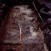
An archaeological evaluation involving the excavation of five trenches was carried out on the site of the former Cowgate Nursery School, Edinburgh. The evaluation demonstrated that significant archaeological deposits survived beneath the proposed development site. The earliest were characterised as medieval midden deposits and were identified in all trenches at a minimum of 1 m below present ground surface. It is clear from a previous borehole survey that these deposits are up to three metres thick in the east of the site. Stone walls, surfaces and culverts were constructed on top of these midden deposits at a minimum depth of only 0.35m below the surface left following demolition of the former nursery. These were likely to have related to buildings constructed on either side of narrow closes, and depicted on maps from the 16th century on. An assemblage of mainly post-medieval artefacts were recovered from the site, although some earlier medieval material was also present.
Information from Headland Archaeology Ltd.
Excavation (March 2004 - December 2004)
An archaeological excavation followed by a watching brief was carried out at 144-166 Cowgate, Edinburgh prior to the construction of sheltered housing on the site. the site is located on the north side of Cowgate and extends from the east side of Fishmarket Close to the current premises of the Siglo nightclub to the east.
The main result of the excavation was the discovery of a clay bonded stone building at the west end of the site believed to be one of the first buildings of medieval date in this part of the Cowgate. Map evidence and pottery retrieved from the building suggests a 14th-15th century date for this building.
The south side of the building was at one stage demolished to make room for a wall that ran parellel with the present line of Cowgate. The wall was 0.8m wide and over 30 m long in total with no other transverse walls abutting or keyed into it suggesting that it was a boundary wall. A section across the full depth of the wall exposed during the watching brief suggested that the wall was built on the north side of a ditch running parallel with the wall.
A second wall was uncovered during the watching brief on the same alignment east of the first wall. This wall was 1.8m wide and at least 8.5m long. Its dimensions, location and alignment strongly suggests that this is a defensive wall most probably the King's Wall commissioned in 1427.
Both walls predate the main development at the Cowgate frontage, which indicates a 15th, or an early 16th century date at the latest. If the walls were part of the King's wall, they would have become obsolete by the construction of the Flodden Wall in 1513. By this time the two walls would have been partly robbed out and probably used in the construction of the early buildings along the Cowgate frontage.
Information from Headland Archaeology Ltd

