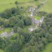
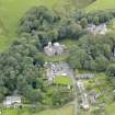
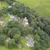
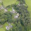
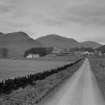
Accessibility

Font Size

100% 150% 200%

Background Colour

Default Contrast
Close Reset

Durisdeer, General

Village (Period Unassigned)

Site Name Durisdeer, General

Classification Village (Period Unassigned)

Canmore ID 120895

Site Number NS80SE 51

NGR NS 8942 0373

NGR Description Centred on NS 8942 0373

Datum OSGB36 - NGR

Permalink http://canmore.org.uk/site/120895

Ordnance Survey licence number AC0000807262. All rights reserved.
Canmore Disclaimer. © Bluesky International Limited 2025. Public Sector Viewing Terms

Toggle Aerial | View on large map

Digital Images

View of Durisdeer Mill, Dumfriesshire.
Oblique aerial view from SW of village with parish church in the centre.Oblique aerial view of Durisdeer, centred on the parish church, taken from the N.Oblique aerial view from NE of village with the parish church in the centre.Oblique aerial view from SE of village with parish church in centre.Oblique aerial view from S of village with parish church in the centre.Oblique aerial view of Durisdeer, centred on the parish church, taken from the SSW.Oblique aerial view of Durisdeer, centred on the parish church, taken from the E.Oblique aerial view of Durisdeer, centred on the parish church, taken from the NE.Distant view of Durisdeer village with church visible.Oblique aerial view from SE of village with the parish church in the centre.Oblique aerial view from SE of village with the parish church in the centre.

Administrative Areas

  • Council Dumfries And Galloway
  • Parish Durisdeer
  • Former Region Dumfries And Galloway
  • Former District Nithsdale
  • Former County Dumfries-shire

Activities

Photographic Survey (1900 - 1930)

Photographs by A Brown & Co of sites across Scotland c1900-1930

References

MyCanmore Image Contributions


Contribute an Image

MyCanmore Text Contributions