
Creag Bhuidhe


Iron Working Site (17th Century)
Site Name Creag Bhuidhe
Classification Iron Working Site (17th Century)
Canmore ID 12078
Site Number NH05NE 1
NGR NH 0690 5905
Datum OSGB36 - NGR
Permalink http://canmore.org.uk/site/12078


- Council Highland
- Parish Gairloch
- Former Region Highland
- Former District Ross And Cromarty
- Former County Ross And Cromarty
NH05NE 1 0690 5905.
(Area centred NH 069590 ) A large quantity of heavy black slag of the oldest variety in scattered heaps lies south of the road. Dixon states that there is no sign of the furnace, though Macadam mentions a building made of stones with slag on them.
J H Dixon 1886
(Area centred NH 070592) More extensive black slag heaps lie north of the road and about 300 yds from it on the 1000 ft. contour.
W I Macadam 1888
At NH 0690 5905 there are traces of charcoal and burnt stones but no iron slag. No trace of iron workings could be found in the area NH 070 592.
Visited by OS (N K B) 26 October 1966
NH 064 594 to NH 101 585 A series of archaeological features were investigated in February and March 2004 that would be disturbed or destroyed with the upgrading of the A832 road. A baseline study had been prepared in 2001, and updated in 2003. The features investigated comprised: former road alignments of the A832 road; an ironworking bloomery site; a former inn reused as a byre; a shieling; and a small shelter or bothy. The excavations dismissed two putative sites - a supposed cairn and structure - as being of entirely natural origin.
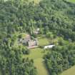
An ironworking bloomery site known as Creag Bhuidhe (NH05NE 1; Site 27) was the most significant discovery made. It occupied a distinct terrace above the confluence of the Glen Docherty Burn and one of its tributaries, which would have provided the water necessary for ironworking. Features identified included a partly disturbed bloomery mound, 10m long and at least 5m wide, composed of black charcoal-rich silt containing much iron slag. To the SE of this was an area with a complex sequence of layers containing slag and lenses of scorched and burnt material. A large slab of solidified ore was found at one point beneath these layers. There was no evidence for a furnace or hearth, nor any other associated structures, although these could have been present outside the areas available for investigation, e.g. beneath the passing place on the current road.
At Lubmore (Site 3; NH 0964 5850) it was demonstrated that the former inn building had probably been reused as a byre or for some other agricultural purpose. The character of former road alignments was established at various points (see NH05NE 6), although nowhere was that character consistent with an 18th-century military road, and in no case was artefactual dating evidence recovered. A small enclosure beside Eas a' Chlamhain (Site 10; NH 0898 5823) was identified as a temporary shelter or bothy, probably for use either by a shepherd or huntsman. Its date was not established, although there is no need to suspect it of being of any great antiquity. Investigation of a shieling (Site 46; NH 0652 5943) provided little additional information to what could be seen from surface evidence.
Report lodged with Highland SMR and the NMRS.
Sponsor: Highland Council, Transport, Environmental and Community Services.
M Johnson 2004

