Pricing Change
New pricing for orders of material from this site will come into place shortly. Charges for supply of digital images, digitisation on demand, prints and licensing will be altered.
Hatton House, Garden, Terrace And Fountain
Garden (18th Century), Garden Ornament(S) (18th Century), Pavilion(S) (18th Century), Sundial(S) (18th Century)
Site Name Hatton House, Garden, Terrace And Fountain
Classification Garden (18th Century), Garden Ornament(S) (18th Century), Pavilion(S) (18th Century), Sundial(S) (18th Century)
Alternative Name(s) Hatton Estate
Canmore ID 120702
Site Number NT16NW 5.03
NGR NT 12860 68768
NGR Description Centred on NT 12860 68768
Datum OSGB36 - NGR
Permalink http://canmore.org.uk/site/120702
- Council Edinburgh, City Of
- Parish Ratho
- Former Region Lothian
- Former District City Of Edinburgh
- Former County Midlothian
Hatton House, 1678 (demolished, 1955)
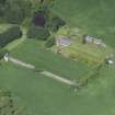
One of the great Renaissance houses of Scotland expanded from an original tower and later Renaissance courtyard by Lord Charles Maitland, brother of the Duke of Lauderdale. It became a great rectangular mansion, circular towers on each corner, its main tower turned into an enormous balustraded viewing platform at the centre. Its surrounding policies were equally imposing - parterres, formal gardens and wilderness - some traces of which - including the ogee-roofed pavilions at each end - remain. Most splendid survival is the magnificent winged gates.
Taken from "West Lothian: An Illustrated Architectural Guide", by Stuart Eydmann, Richard Jaques and Charles McKean, 2008. Published by the Rutland Press http://www.rias.org.uk
NT16NW 5.03 128 688
For temple (NT 1280 6878), see NT16NW 5.02.
Rubble built battered wall with curved bath-house projection at centre and square pavilions. wall; rubble with ashlar dressings. PAVILIONS: 2-stage, square-plan, ogee-roofed classical garden pavilions. Rusticated ashlar at ground level, rubble with harl-pointing at upper level, ashlar dressings, impost and dividing cornices, raised quoins, eaves band and cornice, channelled margins. Entrance to 1st floor from terrace at N; entrance to lower floor from outside to S.
Hatton House was built in the late 17th century by Charles Maitland, subsequently Earl of Lauderdale. The house was the seat of the Lauderdales from 1682-1792. In 1870 the estate was acquired by the Earl of Morton who passed it to his son Lord Aberdour. In more recent times the house belonged to William Whitelaw grandfather of the former MP. The house was burnt in 1952 and demolished in 1955 and the terrace wall, bath house and pavilions along with the garden house and S gates are the only remains of Hatton House. The garden house and S gates are listed separately. In the photographs in JR Findlay's book (1875) the pavilions are unroofed but he does record that in the 1870s repairs and restorations were undertaken by Robert Anderson architect. (Historic Environment Scotland)
Hatton House was one of the great Renaissance houses of Scotland, expanded from an original tower and later Renaissance courtyard by Lord Charles Maitland. Its surrounding policies were equally imposing - parterres, formal gardens and wilderness. (R.Jacques/ C .McKean)
Project (15 September 2009)
An archaeological desk-based assessment, field recording and geophysical surveys were conducted in advance of a proposed development at Hatton House, Ratho. The assessment included a search of databases, documentary, photographic and cartographic records and a field visit. Existing structures within the study area were recorded and described. The geophysical evaluation comprised geomagnetic and electrical resistance surveys in the area of proposed new-build.
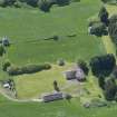
The study area covers an area of approximately 25 hectares and is bounded by fields to the north and east, a lane to the west and the A71 road to the south. The proposed development area comprises a landscaped terrace immediately south of the site of the original Hatton House and the existing bungalow.
The works were commissioned by Holmar Property Developments.
Archaeological Services Durham University. 15 September 2009. OASIS-id: archaeol3-64466
Earth Resistance Survey (15 September 2009)
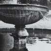
A Resistance survey was undertaken over the site of the former fountain, on the site of a proposed bungalow to the S of the site of Hatton House. The survey indicated an area of central high resistance, interpreted as stone, surrounded by a ring of low resistance, possibly iron.
Archaeological Services Durham University, 15 September 2009. OASIS-id: archaeol3-64466
Magnetometry (15 September 2009)
A fluxgate gradiometry survey was undertaken on the site of a proposed bungalow to the S of the site of Hatton House. The survey revealed a strong positive magnetic anomaly surrounded by a strong negative magnetic anomaly at the site of the former fountain. The intensity of these anomalies suggests the presence of ferrous material, perhaps an iron band, used in the construction of the fountain. Slightly higher resistance to the north of the fountain is likely to reflect a path rather than the ferrous water pipe entering the fountain from the north or exiting the pool southwards to supply the well and bathhouse.
Archaeological Services Durham University, 15 September 2009. OASIS-id: archaeol3-64466
Field Visit (15 September 2009)
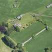
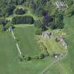
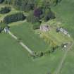
An engraving by John Slezer shows Hatton House (erroneously titled ‘Argile House’) around 1680, and illustrates the extensive gardens. The engraving shows a high wall around the garden with a retaining wall supporting an upper terrace flanked by matching pavilions in the south-east and south-west corners. Formal gardens on the upper terrace are laid out symmetrically around a central water feature, an elaborate fountain. The subsequent water feature was salvaged in the 1960s and has been relocated in a private garden at Birdsmill, Broxburn (McGowen2008, 10). The lower terrace also has a central pool, here at the junction of four broad walks. Woodland is shown beyond the garden wall to the north, east and west. The formal gardens illustrated by Slezer do not survive. The upper terrace is now a lawn, and the field below is also grassed over. There are informal lawns and mature gardens west of the bungalow. Fields under pasture and patches of woodland extend over the remainder of the study area.
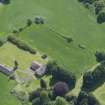
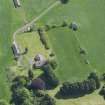
At the south-east and south-west corners of the large terrace in front of the former house are two late 18th-century pavilions. These are described in the statutory list of historic buildings as two-stage, square-plan, ogee-roofed classical garden pavilions. The ground levels are faced with dressed ashlar, and the upper levels are built of rubble, with harl-pointing and ashlar dressings, cornices, raised quoins and eaves bands. The ground floors are reached from east and west in the lower garden, and the entrance to the upper level is on the north side, from the terrace. The east and west face of each pavilion has a large open round arch. That facing the opposite pavilion is dressed ashlar, and its arch has a fluted console keystone and a projecting impost cornice to right and left. The opposite, outer, arches are concealed by tunnel-vaulted chambers that carry the upper stages of staircases linking the terrace with the lower gardens. The lower stages rise across the south faces of the buildings. The pavilions were restored in the 1880s, although photographs in Country Life magazine from 1911 show the west pavilion roofless.
The ground floor of the West Pavillion ( formerly recorded as NT16NW 5.06, Canmore id: 262516) originally probably open like that to the east, has been altered at two different times. Its east arch has been filled with a recessed wall of rusticated ashlar. This has a central door flanked by a pair of windows; all have monolithic lintels that have been dressed to look like angled blocks. The ‘keystone’ of the door is decorated with a more elaborate version of the monogram seen on the summer house. The windows have been blocked up. There is a large circular window above the door, and a moulded string course between the floors. Inside, there is an internal blind window or niche set into the south side of the east wall. Beyond this, the west arch has been reduced by walls at north and south to make a door that opens into the small vaulted chamber under the stair. This measures about 3m by 2m and has a rubble west wall with a central lancet-arched doorway, flanked by matching arched windows. This wall appears to be later than the east blocking wall. On the first floor, there is a single tall central window in the south and east walls, and a blocked modern fireplace built into the west wall; this is the only detail of note here.
The west wall under the staircase is in a very poor state and the area outside is heavily overgrown. The inner lintel of the central door here has fallen out. In the east blocking wall there are signs of possible settlement at the crown of the arch, with open joints in the string course above. The staircase is in a ruinous state and heavily overgrown. The roof slates need attention; a hole in the north side has been patched with a board, and the lead cap or finial is missing.
The East pavilion (formerly NT16NW 5.07 Canmopre id: 262517) is essentially a mirror image of the west pavilion. The ground floor has no blocking wall or niche, and the vaulted under-stair chamber is open at both ends. There is no fireplace on the first floor.
The external stairs to the terrace on the east and south walls are ruinous and overgrown. The outer ring of the arch in the east wall has lost some stone. The slates need repair and the roof timbers are likely to have been affected by water, as the finial is missing.
Archaeological Services Durham University, 15 September 2009. OASIS-id: archaeol3-64466
McGowan, P 2008


