
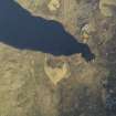
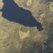
Lochan Na Cairill


Building(S) (Period Unassigned), Enclosure (Period Unassigned), Field Boundary (Period Unassigned), Hut Circle (Prehistoric)
Site Name Lochan Na Cairill
Classification Building(S) (Period Unassigned), Enclosure (Period Unassigned), Field Boundary (Period Unassigned), Hut Circle (Prehistoric)
Canmore ID 12063
Site Number NG99SE 3
NGR NG 9839 9129
Datum OSGB36 - NGR
Permalink http://canmore.org.uk/site/12063


- Council Highland
- Parish Lochbroom
- Former Region Highland
- Former District Ross And Cromarty
- Former County Ross And Cromarty
NG99SE 3 9839 9129
At NG 9839 9129, between 350 and 375 ft OD, on the summit of a small knoll south of Lochan na Cairill, there are the mutilated heather covered remains of a hut circle measuring 8.5m internal diameter with walls 1.5m thick by 0.5m high. The entrance was probably in the east, but cannot be accurately positioned as a segment of this periphery has been completely destroyed. In the immediate vicinity of the hut circle there are the greatly mutilated remains of three field banks, now almost completely overgown, which were composed of large stones, and another on an adjoining knoll which is visible as a heather covered bank 0.3m high. These are probably contemporary with the hut circle, while an 0.7m high earth and stone bank which surrounds the knoll on which the hut circle stands is probably contemporary with the amorphous remains of two drystone buildings to the south.
Visible on RAF air photograph CPE/Scot/UK 321: 4090-1.
Visited by OS (R D) 7 April 1965.

