Pricing Change
New pricing for orders of material from this site will come into place shortly. Charges for supply of digital images, digitisation on demand, prints and licensing will be altered.
Letterewe, Ironworks
Iron Works (17th Century)
Site Name Letterewe, Ironworks
Classification Iron Works (17th Century)
Alternative Name(s) Furnace Burn; Amhainn Na Fuirneis; Loch Maree
Canmore ID 12047
Site Number NG97SE 1
NGR NG 9580 7075
NGR Description Centred NG 9580 7075
Datum OSGB36 - NGR
Permalink http://canmore.org.uk/site/12047
- Council Highland
- Parish Gairloch
- Former Region Highland
- Former District Ross And Cromarty
- Former County Ross And Cromarty
NG97SE 1 centred 9580 7055
See also Red Smiddy (NG87NE 20) for information relating to the location of surviving pig iron ingots.
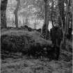
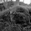
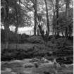
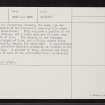
(NG 95817054) The ironworks at Furnace, Letterewe are the earliest historic ironworks in the country. The furnace is situated on the north bank of the Furnace Burn, which flows into Loch Maree about one mile to the south of Letterewe House. The foundations of the furnace are still to be seen, although by no means perfect. They stand on the top of the bank of the burn, which must have materially altered its course since the works were in existence. The furnace was built of Torridon sandstone and brick, masses of which, much vitrified, are still visible in large quantities.
The first mention of these works was in 1610 but they had been established for some time prior as they are shown on Speed's map of 'The Kingdome of Scotland' (1610), and it may have been as early as 1598.
W I Macadam 1893; J H Dixon 1886.
In a small copse on the NW bank of Amhainn na Fuirneis, 20.0m SW of the footbridge crossing the burn, are the mutilated remains of the ironworks, standing 2.3m above the present water-level. They comprise a portion of the wall of the furnace, and 2 large scatters of heavy iron slag 15.0m NE of this. The remains of the furnace, survive to a height of 0.8m, but a fairly modern field wall may partially overlay the remainder. A considerable quantity of vitrified Torridon sandstone is visible in the furnace walling. A scatter of slag, charcoal and burnt material can be seen in the cultivated field immediately to the NW. Surveyed at 1/2500.
Visited by OS (N K B) 5 April 1965.
NG 9580 7075 (centre) Survey and evaluation at Letterewe, Wester Ross, revealed an area of landscape which had undergone substantial changes from the early 17th century to the mid-19th century. The results of a walkover and topographic survey indicate that the study area had gone through a period of landscape transformation as part of an 'Improvement' programme in the early 19th century. Those changes have in effect removed any association between the agricultural settlement pattern and the industrial exploitation of the site during the 17th century.
Geophysical survey and trial trench evaluation at the earlier site on the banks of the Furnace Burn revealed the remains of a charcoal-fired blast furnace and an associated charcoal storage bin, together with other structural features (including pits, walls and hearths within an adjacent field) and deposits of metallurgical waste. Analysis of the metallurgical waste is currently underway. The evidence would appear to support iron production at Letterewe in the early 17th century, possibly associated with Sir George Hay of Nethercliff. (GUARD 537)
A full report will be lodged with the NMRS.
Sponsors: Mr P van Vlissingen and Ms C Tisdale, Letterewe Estate.
M Donnelly, J A Atkinson and E Photos-Jones 1998
Project (August 1996 - November 1996)
NH 011 654 Between August and November 1996 a programme of assessment, survey and excavation was undertaken around Loch Maree, Wester Ross, and specifically on the early 17th-century ironworks at Fasagh. The work focused on the assessment of previously identified ironworking sites, topographic survey, geophysical survey, excavations, and test-pits in support of the geophysics.
In August 1996 an assessment of the Loch Maree area was undertaken as the initial step in the fieldwork programme. In the case of the previously identified bloomery sites no evidence of iron production was noted. The blast furnaces on the other hand remain as impressive monuments. No new bloomery localities were located on the burns traversed. Additional information was recovered for the sites of Fasagh, Letterewe and Red Smiddy, including at Letterewe the presence of haematite ore, and at Red Smiddy and Fasagh the location of settlement possibly related to them and also further structural components of these ironworks.
NG 894 713 Site of Gharbaig, canalised burn, narrow curvilinear channel 15 x 0.2m.
An interim report on this work will be lodged with the NMRS.
Sponsors: Historic Scotland, Letterewe Estate.
J A Atkinson, M Donnelly, J Duncan, O Lelong and E Photos-Jones 1997
Unspecified Geophysical Survey Technique (August 1996 - November 1996)
NH 011 654 Between August and November 1996 a programme of assessment, survey and excavation was undertaken around Loch Maree, Wester Ross, and specifically on the early 17th-century ironworks at Fasagh.
Geophysical survey.
Sponsors: Historic Scotland, Letterewe Estate.
J A Atkinson, M Donnelly, J Duncan, O Lelong and E Photos-Jones 1997


