
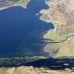
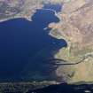
Cille Fhearchair, Shiel Bridge


Burial Ground (Period Unassigned), Standing Stone (Prehistoric)
Site Name Cille Fhearchair, Shiel Bridge
Classification Burial Ground (Period Unassigned), Standing Stone (Prehistoric)
Canmore ID 12000
Site Number NG91NW 1
NGR NG 9387 1879
Datum OSGB36 - NGR
Permalink http://canmore.org.uk/site/12000


- Council Highland
- Parish Glenshiel
- Former Region Highland
- Former District Skye And Lochalsh
- Former County Ross And Cromarty
NG91NW 1 9387 1879.
(NG 9387 1879) Cill Fhearchair (NAT) Standing Stone (NAT)
OS 6"map, Ross-shire, 2nd ed., (1905)
"Cill Fearchair" - Farquhar's Cell or Church - is applied to a disused burial ground. The dedication may be to a saint who does not appear in the Calendars.
W J Watson 1904 and 1926.
Within the burial ground is a standing stone, undressed,
5' 9" high and 1' thick.
Name Book 1874.
This burial ground appears to have consisted of two small co-joined circular enclosures. The northern one, c. 13.5m in diameter is enclosed by a turf-covered wall 1.5m wide by 0.4m max height. The other, abutting on to the S side of the first, is only vaguely visible, its S edge being destroyed by road works. The standing stone lies within this enclosure. No trace of any other internal feature was seen in either enclosure. The stone is within 10.0m of the new roadworks and appears to be in a very vulnerable position.
Surveyed at 1:2500.
Visited by OS (W D J) 26 September 1966.
Srp Note (27 October 2011)
Cill Fhearchair - Fraquhar's cell or church - is the name given to a disused burial ground. The dedication may be to a saint but he does not appear in the Calendars. Within the 'burial ground' is a standing stone, undressed, c1.75m high by 0.3m thick.
The 'burial ground' appears to have consisted of two conjoined circular enclosures. That to the N is c13.5m in diameter with turf-covered walls c1.5m wide surviving up to 0.4m high. That to the S is only just visible as it has been partially destroyed during road-widening works. The standing stone is in this S enclosure, perilously close to the modern road. A 'modern' NTS sign has been inserted into the slight turf dyke of the S enclosure by the road. There are fragmentary remains of walling to N of this complex.
The surviving remains are not obviously recognisable as the site of a former burial ground and are only assumed to be so on the strength of local tradition. The recorded medieval church and burial ground were at Kildowich - St Dubhthach's - on the Nside of the mouth of the river Croe. The 1st and 2nd ed OS maps record that the standing stone was surrounded by a single circular enclosure. The relationship between the S and N circular enclosures is unclear, bearing in mind the details given on the 1st ed OS map.

