
Pricing Change
New pricing for orders of material from this site will come into place shortly. Charges for supply of digital images, digitisation on demand, prints and licensing will be altered.
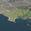
Oskaig, Raasay


Dyke (Period Unassigned), Farmstead (Period Unassigned), Lazy Beds (Post Medieval), Rig And Furrow (Medieval) - (Post Medieval)
Site Name Oskaig, Raasay
Classification Dyke (Period Unassigned), Farmstead (Period Unassigned), Lazy Beds (Post Medieval), Rig And Furrow (Medieval) - (Post Medieval)
Canmore ID 119616
Site Number NG53NW 38
NGR NG 548 382
Datum OSGB36 - NGR
Permalink http://canmore.org.uk/site/119616


- Council Highland
- Parish Portree
- Former Region Highland
- Former District Skye And Lochalsh
- Former County Inverness-shire
NG53NW 38 548 382
NG 547 383 and NG 552 402 The survey of Oskaig and Holoman was carried out by ACFA in April 1995 as part of a continuing survey of the Island of Raasay. The survey team were: I Hughson, A Johnstone, A Macdonald, W Duggan, G Hearns, D McKay, J Waterton, J Macdonald and J S Wood.
NG 5481 3827 Sub-rectangular structure 14m by 10m.
NG 5482 3822 Sub-rectangular structure 15m by 8m.
NG 5475 3829 Area of broad rig/ lazy beds.
NG 5478 3825 to NG 5484 3862 Drystone dyke.
NG 5482 3835 to NG 5467 3842 and NG 5463 3827 Stone dyke.
J Macdonald and J S Wood 1995.
A farmstead comprising one unroofed building and an enclosure is depicted on the 1st edition of the OS 6-inch map (Inverness-shire, Isle of Skye 1879, sheet xxx), but it is not shown on the current edition of the OS 1:10000 map (1986).
Information from RCAHMS (SAH) 4 November 1996

