Accessibility

Font Size

100% 150% 200%

Background Colour

Default Contrast
Close Reset

Edinburgh, Chambers Street, General

General View (Period Unassigned)

Site Name Edinburgh, Chambers Street, General

Classification General View (Period Unassigned)

Canmore ID 119052

Site Number NT27SE 1606

NGR NT 25846 73368

NGR Description NT centred on 2584 7336

Datum OSGB36 - NGR

Permalink http://canmore.org.uk/site/119052

Ordnance Survey licence number AC0000807262. All rights reserved.
Canmore Disclaimer. © Bluesky International Limited 2025. Public Sector Viewing Terms

Toggle Aerial | View on large map

Digital Images

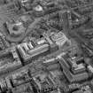
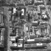
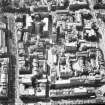
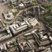
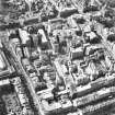
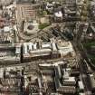
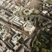
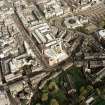
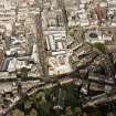
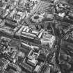
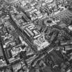
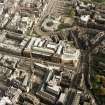
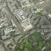
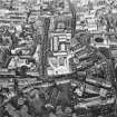
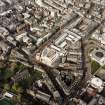
Oblique aerial view of Edinburgh centred on the Museum of Scotland, taken from the NNE.
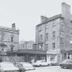
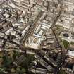
Oblique aerial view of Edinburgh centred on the Museum of Scotland, taken from the NNE.Oblique aerial view of Cowgate and surrounding area, including Chambers Street to left of photograph, George IV Bridge at top, High Street to right and South Bridge at bottomOblique aerial view of Cowgate and surrounding area, including Chambers Street to left of photograph, George IV Bridge at top, High Street to right and South Bridge at bottomOblique aerial view of Edinburgh centred on the Museum of Scotland, taken from the NNE.Oblique aerial view showing area surrounding Cowgate, including Chambers Street to left of photograph, George IV Bridge at top, High Street to right, and South Bridge to bottomGeneral view from North East of Nos 33 - 40 and George Heriot's Hospital School.Oblique aerial view of Edinburgh centred on the Museum of Scotland, taken from the N.Oblique aerial view of Edinburgh centred on the Museum of Scotland, taken from the SW.General view of North elevation of Nos 33 - 40 Chambers Street (now demolished).Oblique aerial view of Edinburgh centred on the Museum of Scotland, taken from the NW.Oblique aerial view of Edinburgh centred on the Museum of Scotland, taken from the W.Oblique aerial view of Edinburgh centred on the Museum of Scotland, taken from the WSW.General view of Nos 33 - 40 Chambers Street (now demolished) from North West.Oblique aerial view of Edinburgh centred on the Royal Museum of Scotland, taken from the NW.Oblique aerial view of Edinburgh centred on the Royal Museum of Scotland, taken from the NW.Oblique aerial view of Edinburgh centred on the Museum of Scotland, taken from the NNW.Oblique aerial view of Edinburgh centred on the Museum of Scotland, taken from the W.  An enlargement of the original photograph.Oblique aerial view of Edinburgh centred on the Museum of Scotland, taken from the WSW.General view of Nos 33 - 40 Chambers Street (now demolished) from South.Oblique aerial view of Edinburgh centred on the Museum of Scotland, taken from the SSW.General view of Nos 33 - 40 Chambers Street (now demolished) from North East.

Administrative Areas

  • Council Edinburgh, City Of
  • Parish Edinburgh (Edinburgh, City Of)
  • Former Region Lothian
  • Former District City Of Edinburgh
  • Former County Midlothian

Architecture Notes

ARCHITECTS: David Cousin -Phrenological Building 1874

John Paterson -East block 1873

ARCHITECT: David Cousin -housing for City Improvement Trust

REFERENCE: PLANS

Dick Peddie & MacKay, Edinburgh Plan and Elevation of Block No 1 (City Improvements)

Bin 4, Bag 3 David Cousin & John Lessels 1873

References

MyCanmore Image Contributions


Contribute an Image

MyCanmore Text Contributions