
South Queensferry


Coastal Battery (Period Unassigned), Landing Point (Period Unassigned), Pier (Period Unassigned)
Site Name South Queensferry
Classification Coastal Battery (Period Unassigned), Landing Point (Period Unassigned), Pier (Period Unassigned)
Alternative Name(s) Forth Defences; Port Neuk
Canmore ID 118880
Site Number NT17NW 190
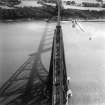
NGR NT 1381 7840
Datum OSGB36 - NGR
Permalink http://canmore.org.uk/site/118880

- Council Edinburgh, City Of
- Parish Dalmeny
- Former Region Lothian
- Former District City Of Edinburgh
- Former County West Lothian
NT17NW 190 1381 7840
"A small stone pier east of Newhalls Pier (now Hawes Pier) was constructed at a cost of #587.11s.11d. It is chiefly used as a landing place for fishing boats and other small craft. It is by the side of a ledge of rock that was one of the old landing places before the new piers were constructed. The old mooring rings and bolts are still in the rock on the W side of the modern construction."
Ordnance Survey Name Book, 1855
This battery was situated in an open area E of the Forth Railway Bridge overlooking the River (Forth) with a low perimeter wall where guns were mounted. Building across the rear of the area.
The battery mounted 2 x 3 pounder Quick Firing (QF) guns which had been installed by 1898.
J A Guy 1997; NMRS MS 810/5, 34-6

