
Pricing Change
New pricing for orders of material from this site will come into place shortly. Charges for supply of digital images, digitisation on demand, prints and licensing will be altered.
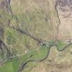
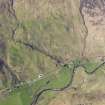
Glen More


Cairn (Period Unassigned)(Possible), Cist (Period Unassigned)
Site Name Glen More
Classification Cairn (Period Unassigned)(Possible), Cist (Period Unassigned)
Canmore ID 11876
Site Number NG82SW 5
NGR NG 84840 20288
Datum OSGB36 - NGR
Permalink http://canmore.org.uk/site/11876


- Council Highland
- Parish Glenelg (Skye And Lochalsh)
- Former Region Highland
- Former District Skye And Lochalsh
- Former County Inverness-shire
NG82SW 5 84840 20288.
(NG 8483 2028) Cist (NR)
OS 6"map, Inverness-shire, 2nd ed., (1902)
A cist containing an urn with human remains was found on top of a gravel mound near Scallisaig House.
M E M Donaldson 1920.
One side and one end stone only remains of this cist, giving measurements of c. 1.4m x c. 0.6m x c. 0.3m deep. A large slab enbedded into the mound, close by the cist, is probably the capstone.
Surveyed at 1:2500.
Visited by OS (R L) 5 October 1966.
This cist occurs in the centre of a turf-covered stony mound 5.8m in diameter and 0.6m high, almost certainly a cairn placed on the summit of a glacial knoll.
Revised at 1:2500.
Visited by OS (A A) 19 June 1974.
Watching Brief (31 October 2008)
NG 8485 2028 A watching brief was carried out during the excavation of a platform for a new house on 31 October 2008. The topsoil was stripped by an excavator using a 2m-wide straight-edged bucket. Nothing of archaeological interest was uncovered.
Archive: RCAHMS (intended). Report: Highland SMR
Funder: Mr W J MacDonald
Martin Wildgoose (Archaeological and Ancient Landscape Survey), 2008

