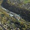
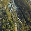
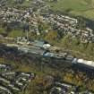
Accessibility

Font Size

100% 150% 200%

Background Colour

Default Contrast
Close Reset

Glenrothes

Town (Period Unassigned)

Site Name Glenrothes

Classification Town (Period Unassigned)

Canmore ID 118564

Site Number NO20SE 125

NGR NO 271 010

Datum OSGB36 - NGR

Permalink http://canmore.org.uk/site/118564

Ordnance Survey licence number AC0000807262. All rights reserved.
Canmore Disclaimer. © Bluesky International Limited 2025. Public Sector Viewing Terms

Toggle Aerial | View on large map

Digital Images

General oblique aerial view of Stenton Roundabout, Glenrothes, looking E.
General oblique aerial view of Stenton Roundabout, Glenrothes, looking E.Oblique aerial view centred on the mill and chimney stack, taken from the NW.Oblique aerial view of Stenton Roundabout, Glenrothes, looking SE.Oblique aerial view centred on the mill and chimney stack, taken from the NNW.Oblique aerial view of the junction between the B921 Kinglassie Road and Crompton Road in Glenrothes, looking E.Glenrothes Development Corporation Markinch, Fife, Scotland. Oblique aerial photograph taken facing East. This image was marked by AeroPictorial Ltd for photo editing.Oblique aerial view centred on the mill and chimney stack, taken from the ENE.

Administrative Areas

  • Council Fife
  • Parish Kinglassie
  • Former Region Fife
  • Former District Kirkcaldy
  • Former County Fife

Archaeology Notes

NO20SE 125.00 271 010

NO20SE 125.01 (formerly ) NO 254 008 Tanshall

NO20SE 125.02 (formerly ) NO 258 003 Caskieberran

NO20SE 125.03 (formerly ) NO 271 010 Town centre

NO20SE 125.04 (formerly ) NO 277 004 Auchmuty

References

MyCanmore Image Contributions


Contribute an Image

MyCanmore Text Contributions