
Eigg, Howlin


Farmstead (Post Medieval)
Site Name Eigg, Howlin
Classification Farmstead (Post Medieval)
Canmore ID 118030
Site Number NM48NE 46
NGR NM 4790 8955
Datum OSGB36 - NGR
Permalink http://canmore.org.uk/site/118030


- Council Highland
- Parish Small Isles
- Former Region Highland
- Former District Lochaber
- Former County Inverness-shire
Field Visit (29 August 2001)
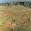
The roofless ruins of two ranges which previously formed a U-plan steading with Howlin House stand immediately to its SW. The house is recorded elsewhere (see NM48NE 49). The NW building (647) measures 7.2m from NE to SW by 3m transversely within faced rubble walls 0.9m in thickness and 0.5m in height, and there is an entrance in the SE wall. The SE building (648) measures 8m from NE to SW by 3.5m transversely within walls 1m in thickness and 0.3m in height.
EIGG01 647, 648
Visited by RCAHMS (AGCH) 29 August 2001
Note
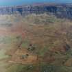
A farmstead, comprising three unroofed buildings enclosing three sides of a courtyard, and an enclosure is depicted on the 1st edition of the OS 6-inch map (Argyllshire & Inverness-shire, Islands of Rum and Eigg 1879, sheet lxxi). One roofed building and an enclosure are shown on the current edition of the OS 1:10000 map (1976).
Information from RCAHMS (AKK) 9 December 1996.

