
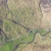
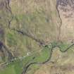
Drochaid An Uillt Mhoir


Farmstead (Period Unassigned), Field System (Period Unassigned)
Site Name Drochaid An Uillt Mhoir
Classification Farmstead (Period Unassigned), Field System (Period Unassigned)
Canmore ID 117972
Site Number NG82SW 16
NGR NG 8472 2027
Datum OSGB36 - NGR
Permalink http://canmore.org.uk/site/117972


- Council Highland
- Parish Glenelg (Skye And Lochalsh)
- Former Region Highland
- Former District Skye And Lochalsh
- Former County Inverness-shire
Note
A farmstead, comprising two unroofed buildings, and a field are depicted on the 1st edition of the OS 6-inch map (Inverness-shire 1876, sheet xlvii), but it is not shown on the current edition of the OS 1:10000 map (1971).
Information from RCAHMS (AKK) 23 July 1996.

