
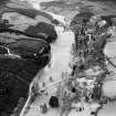
Drumtochty, Saint Palladius Episcopal Church


Burial Ground (19th Century), Church (19th Century) (1885), Churchyard (19th Century)
Site Name Drumtochty, Saint Palladius Episcopal Church
Classification Burial Ground (19th Century), Church (19th Century) (1885), Churchyard (19th Century)
Alternative Name(s) Glen Of Drumtochty
Canmore ID 117714
Site Number NO77NW 61
NGR NO 70743 79874
Datum OSGB36 - NGR
Permalink http://canmore.org.uk/site/117714


- Council Aberdeenshire
- Parish Fordoun
- Former Region Grampian
- Former District Kincardine And Deeside
- Former County Kincardineshire
NMRS REFERENCE:
Architect: Pirie and Clyne, 1885. Early English. (Arthur Clyne).
Project (1 April 2015 - 31 March 2016)
Survey work undertaken to upgrade records of listed buildings by area.

