
Carlops, Spittal


Agricultural Cropmark(S) (Modern), Geological Cropmark(S) (Period Unknown)
Site Name Carlops, Spittal
Classification Agricultural Cropmark(S) (Modern), Geological Cropmark(S) (Period Unknown)
Canmore ID 117712
Site Number NT15NE 62
NGR NT 1726 5751
Datum OSGB36 - NGR
Permalink http://canmore.org.uk/site/117712


- Council Midlothian
- Parish Penicuik (Midlothian)
- Former Region Lothian
- Former District Midlothian
- Former County Midlothian
NT15NE 62 1726 5751
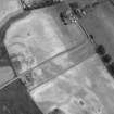
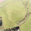
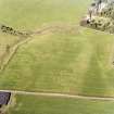
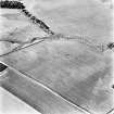
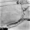
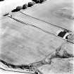
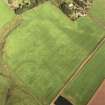
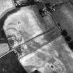
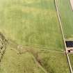
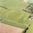
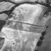
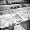
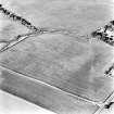
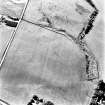
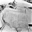
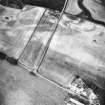
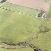
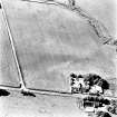
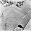
Oblique aerial photography has revealed an area of indeterminate cropmarks and pits 300m ESE of Spittal Farm (NT15NE 5). The most distinctive are a series of arcs of ditch, measuring about 30m to 40m in length, and three sides of a roughly square cropmark about 10m across surrounding a possible pit (RCAHMSAP 1996). These cropmarks intersect the NW side of the annexe of a Roman Temporary Camp (NT15NE 30).
Information from RCAHMS (KJ) 23 February 2000.
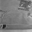
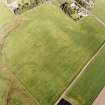
These amorphous cropmarks (RCAHMSAP 1996) are agricultural and geological in origin and include the former locations of two cattle feed bins.
Information from RCAHMS (ACM) 5 May 2008
Aerial Photographic Transcription (14 March 1997 - 29 March 1997)
An aerial transcription was produced from oblique aerial photographs. Information from Historic Environment Scotland (BM) 31 March 2017.

