
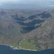
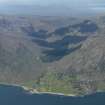
Skye, Kylerhea


Byre(S) (Period Unassigned), Farmstead (Period Unassigned)
Site Name Skye, Kylerhea
Classification Byre(S) (Period Unassigned), Farmstead (Period Unassigned)
Canmore ID 11697
Site Number NG72SE 29
NGR NG 7859 2023
Datum OSGB36 - NGR
Permalink http://canmore.org.uk/site/11697


- Council Highland
- Parish Sleat
- Former Region Highland
- Former District Skye And Lochalsh
- Former County Inverness-shire
NG72SE 29 7859 2023
Situated by the shore at a height of 5m OD lies a large rectangular structure measuring 10m x 4m internally, its wall 1m in width. The north gable still stands, the remainder collapsed at time of recording. Remains of two rectangular structures (byres) lie to the south, both 4m x 4m internally and walls 1m thick.
Information from M Wildgoose to RCAHMS, February 1989.

