
Pricing Change
New pricing for orders of material from this site will come into place shortly. Charges for supply of digital images, digitisation on demand, prints and licensing will be altered.
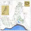
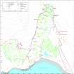
Badentarbat


Round Ended Building (Medieval)(Possible)
Site Name Badentarbat
Classification Round Ended Building (Medieval)(Possible)
Canmore ID 116600
Site Number NC01SW 24.03
NGR NC 0105 1053
Datum OSGB36 - NGR
Permalink http://canmore.org.uk/site/116600


- Council Highland
- Parish Lochbroom
- Former Region Highland
- Former District Ross And Cromarty
- Former County Ross And Cromarty
Field Visit (8 August 1994)
NC01SW 24.03 0105 1053
In bracken-infested ground just beyond the head-dyke enclosing Badentarbat township, and close to its NW corner, there is a building quite different to most of the other buildings in that it has rounded ends and has been built across, rather than along, the slope of the hill. It measures 8m E-W by 2.7m transversely within faced-rubble walls 0.7m thick which stand up to 0.9m high. It has been set into the slope at the W (uphill) end and terraced out on the E, and a drain has been dug around the NW corner, cutting a small cairn probably associated with the hut-circles close by (NC01SW 24.02). The entrance is in the S wall, offset slightly towards the E end and opening into the lowest of three compartments, each of which is marked by a step down from W to E.
(ACHIL94 417)
Visited by RCAHMS (SDB) 8 August 1994
Measured Survey (24 August 1994)
RCAHMS surveyed the round-ended building at Badentarbat with alidade and plane-table on 24 August 1995 at a scale of 1:100. The resultant plan was inked up and published at a scale of 1:200 (RCAHMS 1997c).

