
Pricing Change
New pricing for orders of material from this site will come into place shortly. Charges for supply of digital images, digitisation on demand, prints and licensing will be altered.
Ballourie


Farmstead (Period Unassigned)
Site Name Ballourie
Classification Farmstead (Period Unassigned)
Alternative Name(s) Pitourie
Canmore ID 115897
Site Number NH80NW 13.01
NGR NH 8317 0698
Datum OSGB36 - NGR
Permalink http://canmore.org.uk/site/115897


- Council Highland
- Parish Alvie
- Former Region Highland
- Former District Badenoch And Strathspey
- Former County Inverness-shire
NH80NW 13.01 8317 0698
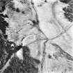
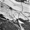
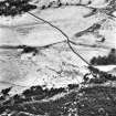
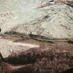
A farmstead, comprising two roofed buildings and two enclosures is depicted on the 1st edition of the OS 6-inch map (Inverness-shire 1874, sheet lxxiii), but it is not shown on the current edition of the OS 1:10000 map (1995).
Information from RCAHMS (AKK) 12 July 1996.

