Villa (19th Century)
Site Name Cardross Park
Classification Villa (19th Century)
Alternative Name(s) 1 - 12 Cardross Park Mansions; Kilmahew Estate; Cardross Assessment Centre
Canmore ID 115432
Site Number NS37NW 23
NGR NS 34540 77745
Datum OSGB36 - NGR
Permalink http://canmore.org.uk/site/115432
Ordnance Survey licence number AC0000807262. All rights reserved.
Canmore Disclaimer.
© Bluesky International Limited 2025. Public Sector Viewing Terms
- Correction
- Favourite

SC 2148819
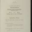
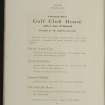
Estates Exchange, London. No.1494, Sale Brochure - map and photographs of Kilmahew Estate. Properties include Kilmahew House and Castle, Lodges, Farm and cottages together with Cairniedrouth Farm, Asker Farm, Kirkton Farm, Cardross Park, High and Low Milndovan Farms, Auchenfroe House, Golf Club House, Wallaceton Farm, Walton Farm, Craigend Farm and Auchensail Farm. Sepia photographs of Kilmahew House (2), Lodge, Cardross Park, Auchenfroe House, Kilmahew Golf House and Course. Also contains plan of Estate which identifies individual lots. November 1919
Collection of sale catalogues relating to Scottish estates
1919
© Courtesy of HES, Courtesy of HES (Estates Exchange Collection)

SC 2148824
Estates Exchange, London. No.1494, Sale Brochure - map and photographs of Kilmahew Estate. Properties include Kilmahew House and Castle, Lodges, Farm and cottages together with Cairniedrouth Farm, Asker Farm, Kirkton Farm, Cardross Park, High and Low Milndovan Farms, Auchenfroe House, Golf Club House, Wallaceton Farm, Walton Farm, Craigend Farm and Auchensail Farm. Sepia photographs of Kilmahew House (2), Lodge, Cardross Park, Auchenfroe House, Kilmahew Golf House and Course. Also contains plan of Estate which identifies individual lots. November 1919
Collection of sale catalogues relating to Scottish estates
1919
© Courtesy of HES, Courtesy of HES (Estates Exchange Collection)

SC 2148828
Estates Exchange, London. No.1494, Sale Brochure - map and photographs of Kilmahew Estate. Properties include Kilmahew House and Castle, Lodges, Farm and cottages together with Cairniedrouth Farm, Asker Farm, Kirkton Farm, Cardross Park, High and Low Milndovan Farms, Auchenfroe House, Golf Club House, Wallaceton Farm, Walton Farm, Craigend Farm and Auchensail Farm. Sepia photographs of Kilmahew House (2), Lodge, Cardross Park, Auchenfroe House, Kilmahew Golf House and Course. Also contains plan of Estate which identifies individual lots. November 1919
Collection of sale catalogues relating to Scottish estates
1919
© Courtesy of HES, Courtesy of HES (Estates Exchange Collection)

SC 2148830
Estates Exchange, London. No.1494, Sale Brochure - map and photographs of Kilmahew Estate. Properties include Kilmahew House and Castle, Lodges, Farm and cottages together with Cairniedrouth Farm, Asker Farm, Kirkton Farm, Cardross Park, High and Low Milndovan Farms, Auchenfroe House, Golf Club House, Wallaceton Farm, Walton Farm, Craigend Farm and Auchensail Farm. Sepia photographs of Kilmahew House (2), Lodge, Cardross Park, Auchenfroe House, Kilmahew Golf House and Course. Also contains plan of Estate which identifies individual lots. November 1919
Collection of sale catalogues relating to Scottish estates
1919
© Courtesy of HES, Courtesy of HES (Estates Exchange Collection)

SC 2148842
Estates Exchange, London. No.1494, Sale Brochure - map and photographs of Kilmahew Estate. Properties include Kilmahew House and Castle, Lodges, Farm and cottages together with Cairniedrouth Farm, Asker Farm, Kirkton Farm, Cardross Park, High and Low Milndovan Farms, Auchenfroe House, Golf Club House, Wallaceton Farm, Walton Farm, Craigend Farm and Auchensail Farm. Sepia photographs of Kilmahew House (2), Lodge, Cardross Park, Auchenfroe House, Kilmahew Golf House and Course. Also contains plan of Estate which identifies individual lots. November 1919
Collection of sale catalogues relating to Scottish estates
1919
© Courtesy of HES, Courtesy of HES (Estates Exchange Collection)

SC 2148850
Estates Exchange, London. No.1494, Sale Brochure - map and photographs of Kilmahew Estate. Properties include Kilmahew House and Castle, Lodges, Farm and cottages together with Cairniedrouth Farm, Asker Farm, Kirkton Farm, Cardross Park, High and Low Milndovan Farms, Auchenfroe House, Golf Club House, Wallaceton Farm, Walton Farm, Craigend Farm and Auchensail Farm. Sepia photographs of Kilmahew House (2), Lodge, Cardross Park, Auchenfroe House, Kilmahew Golf House and Course. Also contains plan of Estate which identifies individual lots. November 1919
Collection of sale catalogues relating to Scottish estates
1919
© Courtesy of HES, Courtesy of HES (Estates Exchange Collection)

SC 2148856
Estates Exchange, London. No.1494, Sale Brochure - map and photographs of Kilmahew Estate. Properties include Kilmahew House and Castle, Lodges, Farm and cottages together with Cairniedrouth Farm, Asker Farm, Kirkton Farm, Cardross Park, High and Low Milndovan Farms, Auchenfroe House, Golf Club House, Wallaceton Farm, Walton Farm, Craigend Farm and Auchensail Farm. Sepia photographs of Kilmahew House (2), Lodge, Cardross Park, Auchenfroe House, Kilmahew Golf House and Course. Also contains plan of Estate which identifies individual lots. November 1919
Collection of sale catalogues relating to Scottish estates
1919
© Courtesy of HES, Courtesy of HES (Estates Exchange Collection)

SC 2148860
Estates Exchange, London. No.1494, Sale Brochure - map and photographs of Kilmahew Estate. Properties include Kilmahew House and Castle, Lodges, Farm and cottages together with Cairniedrouth Farm, Asker Farm, Kirkton Farm, Cardross Park, High and Low Milndovan Farms, Auchenfroe House, Golf Club House, Wallaceton Farm, Walton Farm, Craigend Farm and Auchensail Farm. Sepia photographs of Kilmahew House (2), Lodge, Cardross Park, Auchenfroe House, Kilmahew Golf House and Course. Also contains plan of Estate which identifies individual lots. November 1919
Collection of sale catalogues relating to Scottish estates
1919
© Courtesy of HES, Courtesy of HES (Estates Exchange Collection)

SC 2148879
Estates Exchange, London. No.1494, Sale Brochure - map and photographs of Kilmahew Estate. Properties include Kilmahew House and Castle, Lodges, Farm and cottages together with Cairniedrouth Farm, Asker Farm, Kirkton Farm, Cardross Park, High and Low Milndovan Farms, Auchenfroe House, Golf Club House, Wallaceton Farm, Walton Farm, Craigend Farm and Auchensail Farm. Sepia photographs of Kilmahew House (2), Lodge, Cardross Park, Auchenfroe House, Kilmahew Golf House and Course. Also contains plan of Estate which identifies individual lots. November 1919
Collection of sale catalogues relating to Scottish estates
1919
© Courtesy of HES, Courtesy of HES (Estates Exchange Collection)

SC 2148825
Estates Exchange, London. No.1494, Sale Brochure - map and photographs of Kilmahew Estate. Properties include Kilmahew House and Castle, Lodges, Farm and cottages together with Cairniedrouth Farm, Asker Farm, Kirkton Farm, Cardross Park, High and Low Milndovan Farms, Auchenfroe House, Golf Club House, Wallaceton Farm, Walton Farm, Craigend Farm and Auchensail Farm. Sepia photographs of Kilmahew House (2), Lodge, Cardross Park, Auchenfroe House, Kilmahew Golf House and Course. Also contains plan of Estate which identifies individual lots. November 1919
Collection of sale catalogues relating to Scottish estates
1919
© Courtesy of HES, Courtesy of HES (Estates Exchange Collection)

SC 2148854
Estates Exchange, London. No.1494, Sale Brochure - map and photographs of Kilmahew Estate. Properties include Kilmahew House and Castle, Lodges, Farm and cottages together with Cairniedrouth Farm, Asker Farm, Kirkton Farm, Cardross Park, High and Low Milndovan Farms, Auchenfroe House, Golf Club House, Wallaceton Farm, Walton Farm, Craigend Farm and Auchensail Farm. Sepia photographs of Kilmahew House (2), Lodge, Cardross Park, Auchenfroe House, Kilmahew Golf House and Course. Also contains plan of Estate which identifies individual lots. November 1919
Collection of sale catalogues relating to Scottish estates
1919
© Courtesy of HES, Courtesy of HES (Estates Exchange Collection)

SC 2148863
Estates Exchange, London. No.1494, Sale Brochure - map and photographs of Kilmahew Estate. Properties include Kilmahew House and Castle, Lodges, Farm and cottages together with Cairniedrouth Farm, Asker Farm, Kirkton Farm, Cardross Park, High and Low Milndovan Farms, Auchenfroe House, Golf Club House, Wallaceton Farm, Walton Farm, Craigend Farm and Auchensail Farm. Sepia photographs of Kilmahew House (2), Lodge, Cardross Park, Auchenfroe House, Kilmahew Golf House and Course. Also contains plan of Estate which identifies individual lots. November 1919
Collection of sale catalogues relating to Scottish estates
1919
© Courtesy of HES, Courtesy of HES (Estates Exchange Collection)

SC 2148866
Estates Exchange, London. No.1494, Sale Brochure - map and photographs of Kilmahew Estate. Properties include Kilmahew House and Castle, Lodges, Farm and cottages together with Cairniedrouth Farm, Asker Farm, Kirkton Farm, Cardross Park, High and Low Milndovan Farms, Auchenfroe House, Golf Club House, Wallaceton Farm, Walton Farm, Craigend Farm and Auchensail Farm. Sepia photographs of Kilmahew House (2), Lodge, Cardross Park, Auchenfroe House, Kilmahew Golf House and Course. Also contains plan of Estate which identifies individual lots. November 1919
Collection of sale catalogues relating to Scottish estates
1919
© Courtesy of HES, Courtesy of HES (Estates Exchange Collection)

SC 2148867
Estates Exchange, London. No.1494, Sale Brochure - map and photographs of Kilmahew Estate. Properties include Kilmahew House and Castle, Lodges, Farm and cottages together with Cairniedrouth Farm, Asker Farm, Kirkton Farm, Cardross Park, High and Low Milndovan Farms, Auchenfroe House, Golf Club House, Wallaceton Farm, Walton Farm, Craigend Farm and Auchensail Farm. Sepia photographs of Kilmahew House (2), Lodge, Cardross Park, Auchenfroe House, Kilmahew Golf House and Course. Also contains plan of Estate which identifies individual lots. November 1919
Collection of sale catalogues relating to Scottish estates
1919
© Courtesy of HES, Courtesy of HES (Estates Exchange Collection)

SC 2148872
Estates Exchange, London. No.1494, Sale Brochure - map and photographs of Kilmahew Estate. Properties include Kilmahew House and Castle, Lodges, Farm and cottages together with Cairniedrouth Farm, Asker Farm, Kirkton Farm, Cardross Park, High and Low Milndovan Farms, Auchenfroe House, Golf Club House, Wallaceton Farm, Walton Farm, Craigend Farm and Auchensail Farm. Sepia photographs of Kilmahew House (2), Lodge, Cardross Park, Auchenfroe House, Kilmahew Golf House and Course. Also contains plan of Estate which identifies individual lots. November 1919
Collection of sale catalogues relating to Scottish estates
1919
© Courtesy of HES, Courtesy of HES (Estates Exchange Collection)

SC 2148826
Estates Exchange, London. No.1494, Sale Brochure - map and photographs of Kilmahew Estate. Properties include Kilmahew House and Castle, Lodges, Farm and cottages together with Cairniedrouth Farm, Asker Farm, Kirkton Farm, Cardross Park, High and Low Milndovan Farms, Auchenfroe House, Golf Club House, Wallaceton Farm, Walton Farm, Craigend Farm and Auchensail Farm. Sepia photographs of Kilmahew House (2), Lodge, Cardross Park, Auchenfroe House, Kilmahew Golf House and Course. Also contains plan of Estate which identifies individual lots. November 1919
Collection of sale catalogues relating to Scottish estates
1919
© Courtesy of HES, Courtesy of HES (Estates Exchange Collection)

SC 2148831
Estates Exchange, London. No.1494, Sale Brochure - map and photographs of Kilmahew Estate. Properties include Kilmahew House and Castle, Lodges, Farm and cottages together with Cairniedrouth Farm, Asker Farm, Kirkton Farm, Cardross Park, High and Low Milndovan Farms, Auchenfroe House, Golf Club House, Wallaceton Farm, Walton Farm, Craigend Farm and Auchensail Farm. Sepia photographs of Kilmahew House (2), Lodge, Cardross Park, Auchenfroe House, Kilmahew Golf House and Course. Also contains plan of Estate which identifies individual lots. November 1919
Collection of sale catalogues relating to Scottish estates
1919
© Courtesy of HES, Courtesy of HES (Estates Exchange Collection)

SC 2148833
Estates Exchange, London. No.1494, Sale Brochure - map and photographs of Kilmahew Estate. Properties include Kilmahew House and Castle, Lodges, Farm and cottages together with Cairniedrouth Farm, Asker Farm, Kirkton Farm, Cardross Park, High and Low Milndovan Farms, Auchenfroe House, Golf Club House, Wallaceton Farm, Walton Farm, Craigend Farm and Auchensail Farm. Sepia photographs of Kilmahew House (2), Lodge, Cardross Park, Auchenfroe House, Kilmahew Golf House and Course. Also contains plan of Estate which identifies individual lots. November 1919
Collection of sale catalogues relating to Scottish estates
1919
© Courtesy of HES, Courtesy of HES (Estates Exchange Collection)

SC 2148836
Estates Exchange, London. No.1494, Sale Brochure - map and photographs of Kilmahew Estate. Properties include Kilmahew House and Castle, Lodges, Farm and cottages together with Cairniedrouth Farm, Asker Farm, Kirkton Farm, Cardross Park, High and Low Milndovan Farms, Auchenfroe House, Golf Club House, Wallaceton Farm, Walton Farm, Craigend Farm and Auchensail Farm. Sepia photographs of Kilmahew House (2), Lodge, Cardross Park, Auchenfroe House, Kilmahew Golf House and Course. Also contains plan of Estate which identifies individual lots. November 1919
Collection of sale catalogues relating to Scottish estates
1919
© Courtesy of HES, Courtesy of HES (Estates Exchange Collection)

SC 2148839
Estates Exchange, London. No.1494, Sale Brochure - map and photographs of Kilmahew Estate. Properties include Kilmahew House and Castle, Lodges, Farm and cottages together with Cairniedrouth Farm, Asker Farm, Kirkton Farm, Cardross Park, High and Low Milndovan Farms, Auchenfroe House, Golf Club House, Wallaceton Farm, Walton Farm, Craigend Farm and Auchensail Farm. Sepia photographs of Kilmahew House (2), Lodge, Cardross Park, Auchenfroe House, Kilmahew Golf House and Course. Also contains plan of Estate which identifies individual lots. November 1919
Collection of sale catalogues relating to Scottish estates
1919
© Courtesy of HES, Courtesy of HES (Estates Exchange Collection)

SC 2148841
Estates Exchange, London. No.1494, Sale Brochure - map and photographs of Kilmahew Estate. Properties include Kilmahew House and Castle, Lodges, Farm and cottages together with Cairniedrouth Farm, Asker Farm, Kirkton Farm, Cardross Park, High and Low Milndovan Farms, Auchenfroe House, Golf Club House, Wallaceton Farm, Walton Farm, Craigend Farm and Auchensail Farm. Sepia photographs of Kilmahew House (2), Lodge, Cardross Park, Auchenfroe House, Kilmahew Golf House and Course. Also contains plan of Estate which identifies individual lots. November 1919
Collection of sale catalogues relating to Scottish estates
1919
© Courtesy of HES, Courtesy of HES (Estates Exchange Collection)

SC 2148849
Estates Exchange, London. No.1494, Sale Brochure - map and photographs of Kilmahew Estate. Properties include Kilmahew House and Castle, Lodges, Farm and cottages together with Cairniedrouth Farm, Asker Farm, Kirkton Farm, Cardross Park, High and Low Milndovan Farms, Auchenfroe House, Golf Club House, Wallaceton Farm, Walton Farm, Craigend Farm and Auchensail Farm. Sepia photographs of Kilmahew House (2), Lodge, Cardross Park, Auchenfroe House, Kilmahew Golf House and Course. Also contains plan of Estate which identifies individual lots. November 1919
Collection of sale catalogues relating to Scottish estates
1919
© Courtesy of HES, Courtesy of HES (Estates Exchange Collection)

SC 2148862
Estates Exchange, London. No.1494, Sale Brochure - map and photographs of Kilmahew Estate. Properties include Kilmahew House and Castle, Lodges, Farm and cottages together with Cairniedrouth Farm, Asker Farm, Kirkton Farm, Cardross Park, High and Low Milndovan Farms, Auchenfroe House, Golf Club House, Wallaceton Farm, Walton Farm, Craigend Farm and Auchensail Farm. Sepia photographs of Kilmahew House (2), Lodge, Cardross Park, Auchenfroe House, Kilmahew Golf House and Course. Also contains plan of Estate which identifies individual lots. November 1919
Collection of sale catalogues relating to Scottish estates
1919
© Courtesy of HES, Courtesy of HES (Estates Exchange Collection)

SC 2148865
Estates Exchange, London. No.1494, Sale Brochure - map and photographs of Kilmahew Estate. Properties include Kilmahew House and Castle, Lodges, Farm and cottages together with Cairniedrouth Farm, Asker Farm, Kirkton Farm, Cardross Park, High and Low Milndovan Farms, Auchenfroe House, Golf Club House, Wallaceton Farm, Walton Farm, Craigend Farm and Auchensail Farm. Sepia photographs of Kilmahew House (2), Lodge, Cardross Park, Auchenfroe House, Kilmahew Golf House and Course. Also contains plan of Estate which identifies individual lots. November 1919
Collection of sale catalogues relating to Scottish estates
1919
© Courtesy of HES, Courtesy of HES (Estates Exchange Collection)

SC 2148868
Estates Exchange, London. No.1494, Sale Brochure - map and photographs of Kilmahew Estate. Properties include Kilmahew House and Castle, Lodges, Farm and cottages together with Cairniedrouth Farm, Asker Farm, Kirkton Farm, Cardross Park, High and Low Milndovan Farms, Auchenfroe House, Golf Club House, Wallaceton Farm, Walton Farm, Craigend Farm and Auchensail Farm. Sepia photographs of Kilmahew House (2), Lodge, Cardross Park, Auchenfroe House, Kilmahew Golf House and Course. Also contains plan of Estate which identifies individual lots. November 1919
Collection of sale catalogues relating to Scottish estates
1919
© Courtesy of HES, Courtesy of HES (Estates Exchange Collection)

SC 2148878
Estates Exchange, London. No.1494, Sale Brochure - map and photographs of Kilmahew Estate. Properties include Kilmahew House and Castle, Lodges, Farm and cottages together with Cairniedrouth Farm, Asker Farm, Kirkton Farm, Cardross Park, High and Low Milndovan Farms, Auchenfroe House, Golf Club House, Wallaceton Farm, Walton Farm, Craigend Farm and Auchensail Farm. Sepia photographs of Kilmahew House (2), Lodge, Cardross Park, Auchenfroe House, Kilmahew Golf House and Course. Also contains plan of Estate which identifies individual lots. November 1919
Collection of sale catalogues relating to Scottish estates
1919
© Courtesy of HES, Courtesy of HES (Estates Exchange Collection)

SC 2148822
Estates Exchange, London. No.1494, Sale Brochure - map and photographs of Kilmahew Estate. Properties include Kilmahew House and Castle, Lodges, Farm and cottages together with Cairniedrouth Farm, Asker Farm, Kirkton Farm, Cardross Park, High and Low Milndovan Farms, Auchenfroe House, Golf Club House, Wallaceton Farm, Walton Farm, Craigend Farm and Auchensail Farm. Sepia photographs of Kilmahew House (2), Lodge, Cardross Park, Auchenfroe House, Kilmahew Golf House and Course. Also contains plan of Estate which identifies individual lots. November 1919
Collection of sale catalogues relating to Scottish estates
1919
© Courtesy of HES, Courtesy of HES (Estates Exchange Collection)

SC 2148832
Estates Exchange, London. No.1494, Sale Brochure - map and photographs of Kilmahew Estate. Properties include Kilmahew House and Castle, Lodges, Farm and cottages together with Cairniedrouth Farm, Asker Farm, Kirkton Farm, Cardross Park, High and Low Milndovan Farms, Auchenfroe House, Golf Club House, Wallaceton Farm, Walton Farm, Craigend Farm and Auchensail Farm. Sepia photographs of Kilmahew House (2), Lodge, Cardross Park, Auchenfroe House, Kilmahew Golf House and Course. Also contains plan of Estate which identifies individual lots. November 1919
Collection of sale catalogues relating to Scottish estates
1919
© Courtesy of HES, Courtesy of HES (Estates Exchange Collection)

SC 2148837
Estates Exchange, London. No.1494, Sale Brochure - map and photographs of Kilmahew Estate. Properties include Kilmahew House and Castle, Lodges, Farm and cottages together with Cairniedrouth Farm, Asker Farm, Kirkton Farm, Cardross Park, High and Low Milndovan Farms, Auchenfroe House, Golf Club House, Wallaceton Farm, Walton Farm, Craigend Farm and Auchensail Farm. Sepia photographs of Kilmahew House (2), Lodge, Cardross Park, Auchenfroe House, Kilmahew Golf House and Course. Also contains plan of Estate which identifies individual lots. November 1919
Collection of sale catalogues relating to Scottish estates
1919
© Courtesy of HES, Courtesy of HES (Estates Exchange Collection)

SC 2148845
Estates Exchange, London. No.1494, Sale Brochure - map and photographs of Kilmahew Estate. Properties include Kilmahew House and Castle, Lodges, Farm and cottages together with Cairniedrouth Farm, Asker Farm, Kirkton Farm, Cardross Park, High and Low Milndovan Farms, Auchenfroe House, Golf Club House, Wallaceton Farm, Walton Farm, Craigend Farm and Auchensail Farm. Sepia photographs of Kilmahew House (2), Lodge, Cardross Park, Auchenfroe House, Kilmahew Golf House and Course. Also contains plan of Estate which identifies individual lots. November 1919
Collection of sale catalogues relating to Scottish estates
1919
© Courtesy of HES, Courtesy of HES (Estates Exchange Collection)

SC 2148847
Estates Exchange, London. No.1494, Sale Brochure - map and photographs of Kilmahew Estate. Properties include Kilmahew House and Castle, Lodges, Farm and cottages together with Cairniedrouth Farm, Asker Farm, Kirkton Farm, Cardross Park, High and Low Milndovan Farms, Auchenfroe House, Golf Club House, Wallaceton Farm, Walton Farm, Craigend Farm and Auchensail Farm. Sepia photographs of Kilmahew House (2), Lodge, Cardross Park, Auchenfroe House, Kilmahew Golf House and Course. Also contains plan of Estate which identifies individual lots. November 1919
Collection of sale catalogues relating to Scottish estates
1919
© Courtesy of HES, Courtesy of HES (Estates Exchange Collection)

SC 2148853
Estates Exchange, London. No.1494, Sale Brochure - map and photographs of Kilmahew Estate. Properties include Kilmahew House and Castle, Lodges, Farm and cottages together with Cairniedrouth Farm, Asker Farm, Kirkton Farm, Cardross Park, High and Low Milndovan Farms, Auchenfroe House, Golf Club House, Wallaceton Farm, Walton Farm, Craigend Farm and Auchensail Farm. Sepia photographs of Kilmahew House (2), Lodge, Cardross Park, Auchenfroe House, Kilmahew Golf House and Course. Also contains plan of Estate which identifies individual lots. November 1919
Collection of sale catalogues relating to Scottish estates
1919
© Courtesy of HES, Courtesy of HES (Estates Exchange Collection)

SC 2148861
Estates Exchange, London. No.1494, Sale Brochure - map and photographs of Kilmahew Estate. Properties include Kilmahew House and Castle, Lodges, Farm and cottages together with Cairniedrouth Farm, Asker Farm, Kirkton Farm, Cardross Park, High and Low Milndovan Farms, Auchenfroe House, Golf Club House, Wallaceton Farm, Walton Farm, Craigend Farm and Auchensail Farm. Sepia photographs of Kilmahew House (2), Lodge, Cardross Park, Auchenfroe House, Kilmahew Golf House and Course. Also contains plan of Estate which identifies individual lots. November 1919
Collection of sale catalogues relating to Scottish estates
1919
© Courtesy of HES, Courtesy of HES (Estates Exchange Collection)

SC 2148874
Estates Exchange, London. No.1494, Sale Brochure - map and photographs of Kilmahew Estate. Properties include Kilmahew House and Castle, Lodges, Farm and cottages together with Cairniedrouth Farm, Asker Farm, Kirkton Farm, Cardross Park, High and Low Milndovan Farms, Auchenfroe House, Golf Club House, Wallaceton Farm, Walton Farm, Craigend Farm and Auchensail Farm. Sepia photographs of Kilmahew House (2), Lodge, Cardross Park, Auchenfroe House, Kilmahew Golf House and Course. Also contains plan of Estate which identifies individual lots. November 1919
Collection of sale catalogues relating to Scottish estates
1919
© Courtesy of HES, Courtesy of HES (Estates Exchange Collection)

SC 2148876
Estates Exchange, London. No.1494, Sale Brochure - map and photographs of Kilmahew Estate. Properties include Kilmahew House and Castle, Lodges, Farm and cottages together with Cairniedrouth Farm, Asker Farm, Kirkton Farm, Cardross Park, High and Low Milndovan Farms, Auchenfroe House, Golf Club House, Wallaceton Farm, Walton Farm, Craigend Farm and Auchensail Farm. Sepia photographs of Kilmahew House (2), Lodge, Cardross Park, Auchenfroe House, Kilmahew Golf House and Course. Also contains plan of Estate which identifies individual lots. November 1919
Collection of sale catalogues relating to Scottish estates
1919
© Courtesy of HES, Courtesy of HES (Estates Exchange Collection)

SC 2148823
Estates Exchange, London. No.1494, Sale Brochure - map and photographs of Kilmahew Estate. Properties include Kilmahew House and Castle, Lodges, Farm and cottages together with Cairniedrouth Farm, Asker Farm, Kirkton Farm, Cardross Park, High and Low Milndovan Farms, Auchenfroe House, Golf Club House, Wallaceton Farm, Walton Farm, Craigend Farm and Auchensail Farm. Sepia photographs of Kilmahew House (2), Lodge, Cardross Park, Auchenfroe House, Kilmahew Golf House and Course. Also contains plan of Estate which identifies individual lots. November 1919
Collection of sale catalogues relating to Scottish estates
1919
© Courtesy of HES, Courtesy of HES (Estates Exchange Collection)

SC 2148829
Estates Exchange, London. No.1494, Sale Brochure - map and photographs of Kilmahew Estate. Properties include Kilmahew House and Castle, Lodges, Farm and cottages together with Cairniedrouth Farm, Asker Farm, Kirkton Farm, Cardross Park, High and Low Milndovan Farms, Auchenfroe House, Golf Club House, Wallaceton Farm, Walton Farm, Craigend Farm and Auchensail Farm. Sepia photographs of Kilmahew House (2), Lodge, Cardross Park, Auchenfroe House, Kilmahew Golf House and Course. Also contains plan of Estate which identifies individual lots. November 1919
Collection of sale catalogues relating to Scottish estates
1919
© Courtesy of HES, Courtesy of HES (Estates Exchange Collection)

SC 2148859
Estates Exchange, London. No.1494, Sale Brochure - map and photographs of Kilmahew Estate. Properties include Kilmahew House and Castle, Lodges, Farm and cottages together with Cairniedrouth Farm, Asker Farm, Kirkton Farm, Cardross Park, High and Low Milndovan Farms, Auchenfroe House, Golf Club House, Wallaceton Farm, Walton Farm, Craigend Farm and Auchensail Farm. Sepia photographs of Kilmahew House (2), Lodge, Cardross Park, Auchenfroe House, Kilmahew Golf House and Course. Also contains plan of Estate which identifies individual lots. November 1919
Collection of sale catalogues relating to Scottish estates
1919
© Courtesy of HES, Courtesy of HES (Estates Exchange Collection)

SC 2148864
Estates Exchange, London. No.1494, Sale Brochure - map and photographs of Kilmahew Estate. Properties include Kilmahew House and Castle, Lodges, Farm and cottages together with Cairniedrouth Farm, Asker Farm, Kirkton Farm, Cardross Park, High and Low Milndovan Farms, Auchenfroe House, Golf Club House, Wallaceton Farm, Walton Farm, Craigend Farm and Auchensail Farm. Sepia photographs of Kilmahew House (2), Lodge, Cardross Park, Auchenfroe House, Kilmahew Golf House and Course. Also contains plan of Estate which identifies individual lots. November 1919
Collection of sale catalogues relating to Scottish estates
1919
© Courtesy of HES, Courtesy of HES (Estates Exchange Collection)

SC 2148869
Estates Exchange, London. No.1494, Sale Brochure - map and photographs of Kilmahew Estate. Properties include Kilmahew House and Castle, Lodges, Farm and cottages together with Cairniedrouth Farm, Asker Farm, Kirkton Farm, Cardross Park, High and Low Milndovan Farms, Auchenfroe House, Golf Club House, Wallaceton Farm, Walton Farm, Craigend Farm and Auchensail Farm. Sepia photographs of Kilmahew House (2), Lodge, Cardross Park, Auchenfroe House, Kilmahew Golf House and Course. Also contains plan of Estate which identifies individual lots. November 1919
Collection of sale catalogues relating to Scottish estates
1919
© Courtesy of HES, Courtesy of HES (Estates Exchange Collection)

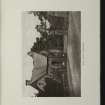
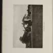
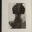
DP 194935
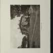
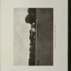
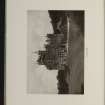
View of Cardross Park.
Collection of sale catalogues relating to Scottish estates
1919
© Courtesy of HES, Courtesy of HES (Estates Exchange Collection)

SC 2148816
Estates Exchange, London. No.1494, Sale Brochure - map and photographs of Kilmahew Estate. Properties include Kilmahew House and Castle, Lodges, Farm and cottages together with Cairniedrouth Farm, Asker Farm, Kirkton Farm, Cardross Park, High and Low Milndovan Farms, Auchenfroe House, Golf Club House, Wallaceton Farm, Walton Farm, Craigend Farm and Auchensail Farm. Sepia photographs of Kilmahew House (2), Lodge, Cardross Park, Auchenfroe House, Kilmahew Golf House and Course. Also contains plan of Estate which identifies individual lots. November 1919
Collection of sale catalogues relating to Scottish estates
1919
© Courtesy of HES, Courtesy of HES (Estates Exchange Collection)

SC 2148821
Estates Exchange, London. No.1494, Sale Brochure - map and photographs of Kilmahew Estate. Properties include Kilmahew House and Castle, Lodges, Farm and cottages together with Cairniedrouth Farm, Asker Farm, Kirkton Farm, Cardross Park, High and Low Milndovan Farms, Auchenfroe House, Golf Club House, Wallaceton Farm, Walton Farm, Craigend Farm and Auchensail Farm. Sepia photographs of Kilmahew House (2), Lodge, Cardross Park, Auchenfroe House, Kilmahew Golf House and Course. Also contains plan of Estate which identifies individual lots. November 1919
Collection of sale catalogues relating to Scottish estates
1919
© Courtesy of HES, Courtesy of HES (Estates Exchange Collection)

SC 2148873
Estates Exchange, London. No.1494, Sale Brochure - map and photographs of Kilmahew Estate. Properties include Kilmahew House and Castle, Lodges, Farm and cottages together with Cairniedrouth Farm, Asker Farm, Kirkton Farm, Cardross Park, High and Low Milndovan Farms, Auchenfroe House, Golf Club House, Wallaceton Farm, Walton Farm, Craigend Farm and Auchensail Farm. Sepia photographs of Kilmahew House (2), Lodge, Cardross Park, Auchenfroe House, Kilmahew Golf House and Course. Also contains plan of Estate which identifies individual lots. November 1919
Collection of sale catalogues relating to Scottish estates
1919
© Courtesy of HES, Courtesy of HES (Estates Exchange Collection)

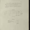
DP 194929
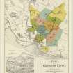
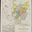
Plan of the Kilmahew Estate in 1919.
Collection of sale catalogues relating to Scottish estates
1919
© Courtesy of HES, Courtesy of HES (Estates Exchange Collection)

SC 2148818
Estates Exchange, London. No.1494, Sale Brochure - map and photographs of Kilmahew Estate. Properties include Kilmahew House and Castle, Lodges, Farm and cottages together with Cairniedrouth Farm, Asker Farm, Kirkton Farm, Cardross Park, High and Low Milndovan Farms, Auchenfroe House, Golf Club House, Wallaceton Farm, Walton Farm, Craigend Farm and Auchensail Farm. Sepia photographs of Kilmahew House (2), Lodge, Cardross Park, Auchenfroe House, Kilmahew Golf House and Course. Also contains plan of Estate which identifies individual lots. November 1919
Collection of sale catalogues relating to Scottish estates
1919
© Courtesy of HES, Courtesy of HES (Estates Exchange Collection)

SC 2148820
Estates Exchange, London. No.1494, Sale Brochure - map and photographs of Kilmahew Estate. Properties include Kilmahew House and Castle, Lodges, Farm and cottages together with Cairniedrouth Farm, Asker Farm, Kirkton Farm, Cardross Park, High and Low Milndovan Farms, Auchenfroe House, Golf Club House, Wallaceton Farm, Walton Farm, Craigend Farm and Auchensail Farm. Sepia photographs of Kilmahew House (2), Lodge, Cardross Park, Auchenfroe House, Kilmahew Golf House and Course. Also contains plan of Estate which identifies individual lots. November 1919
Collection of sale catalogues relating to Scottish estates
1919
© Courtesy of HES, Courtesy of HES (Estates Exchange Collection)

SC 2148827
Estates Exchange, London. No.1494, Sale Brochure - map and photographs of Kilmahew Estate. Properties include Kilmahew House and Castle, Lodges, Farm and cottages together with Cairniedrouth Farm, Asker Farm, Kirkton Farm, Cardross Park, High and Low Milndovan Farms, Auchenfroe House, Golf Club House, Wallaceton Farm, Walton Farm, Craigend Farm and Auchensail Farm. Sepia photographs of Kilmahew House (2), Lodge, Cardross Park, Auchenfroe House, Kilmahew Golf House and Course. Also contains plan of Estate which identifies individual lots. November 1919
Collection of sale catalogues relating to Scottish estates
1919
© Courtesy of HES, Courtesy of HES (Estates Exchange Collection)

SC 2148835
Estates Exchange, London. No.1494, Sale Brochure - map and photographs of Kilmahew Estate. Properties include Kilmahew House and Castle, Lodges, Farm and cottages together with Cairniedrouth Farm, Asker Farm, Kirkton Farm, Cardross Park, High and Low Milndovan Farms, Auchenfroe House, Golf Club House, Wallaceton Farm, Walton Farm, Craigend Farm and Auchensail Farm. Sepia photographs of Kilmahew House (2), Lodge, Cardross Park, Auchenfroe House, Kilmahew Golf House and Course. Also contains plan of Estate which identifies individual lots. November 1919
Collection of sale catalogues relating to Scottish estates
1919
© Courtesy of HES, Courtesy of HES (Estates Exchange Collection)

SC 2148838
Estates Exchange, London. No.1494, Sale Brochure - map and photographs of Kilmahew Estate. Properties include Kilmahew House and Castle, Lodges, Farm and cottages together with Cairniedrouth Farm, Asker Farm, Kirkton Farm, Cardross Park, High and Low Milndovan Farms, Auchenfroe House, Golf Club House, Wallaceton Farm, Walton Farm, Craigend Farm and Auchensail Farm. Sepia photographs of Kilmahew House (2), Lodge, Cardross Park, Auchenfroe House, Kilmahew Golf House and Course. Also contains plan of Estate which identifies individual lots. November 1919
Collection of sale catalogues relating to Scottish estates
1919
© Courtesy of HES, Courtesy of HES (Estates Exchange Collection)

SC 2148840
Estates Exchange, London. No.1494, Sale Brochure - map and photographs of Kilmahew Estate. Properties include Kilmahew House and Castle, Lodges, Farm and cottages together with Cairniedrouth Farm, Asker Farm, Kirkton Farm, Cardross Park, High and Low Milndovan Farms, Auchenfroe House, Golf Club House, Wallaceton Farm, Walton Farm, Craigend Farm and Auchensail Farm. Sepia photographs of Kilmahew House (2), Lodge, Cardross Park, Auchenfroe House, Kilmahew Golf House and Course. Also contains plan of Estate which identifies individual lots. November 1919
Collection of sale catalogues relating to Scottish estates
1919
© Courtesy of HES, Courtesy of HES (Estates Exchange Collection)

SC 2148843
Estates Exchange, London. No.1494, Sale Brochure - map and photographs of Kilmahew Estate. Properties include Kilmahew House and Castle, Lodges, Farm and cottages together with Cairniedrouth Farm, Asker Farm, Kirkton Farm, Cardross Park, High and Low Milndovan Farms, Auchenfroe House, Golf Club House, Wallaceton Farm, Walton Farm, Craigend Farm and Auchensail Farm. Sepia photographs of Kilmahew House (2), Lodge, Cardross Park, Auchenfroe House, Kilmahew Golf House and Course. Also contains plan of Estate which identifies individual lots. November 1919
Collection of sale catalogues relating to Scottish estates
1919
© Courtesy of HES, Courtesy of HES (Estates Exchange Collection)

SC 2148844
Estates Exchange, London. No.1494, Sale Brochure - map and photographs of Kilmahew Estate. Properties include Kilmahew House and Castle, Lodges, Farm and cottages together with Cairniedrouth Farm, Asker Farm, Kirkton Farm, Cardross Park, High and Low Milndovan Farms, Auchenfroe House, Golf Club House, Wallaceton Farm, Walton Farm, Craigend Farm and Auchensail Farm. Sepia photographs of Kilmahew House (2), Lodge, Cardross Park, Auchenfroe House, Kilmahew Golf House and Course. Also contains plan of Estate which identifies individual lots. November 1919
Collection of sale catalogues relating to Scottish estates
1919
© Courtesy of HES, Courtesy of HES (Estates Exchange Collection)

SC 2148852
Estates Exchange, London. No.1494, Sale Brochure - map and photographs of Kilmahew Estate. Properties include Kilmahew House and Castle, Lodges, Farm and cottages together with Cairniedrouth Farm, Asker Farm, Kirkton Farm, Cardross Park, High and Low Milndovan Farms, Auchenfroe House, Golf Club House, Wallaceton Farm, Walton Farm, Craigend Farm and Auchensail Farm. Sepia photographs of Kilmahew House (2), Lodge, Cardross Park, Auchenfroe House, Kilmahew Golf House and Course. Also contains plan of Estate which identifies individual lots. November 1919
Collection of sale catalogues relating to Scottish estates
1919
© Courtesy of HES, Courtesy of HES (Estates Exchange Collection)

SC 2148855
Estates Exchange, London. No.1494, Sale Brochure - map and photographs of Kilmahew Estate. Properties include Kilmahew House and Castle, Lodges, Farm and cottages together with Cairniedrouth Farm, Asker Farm, Kirkton Farm, Cardross Park, High and Low Milndovan Farms, Auchenfroe House, Golf Club House, Wallaceton Farm, Walton Farm, Craigend Farm and Auchensail Farm. Sepia photographs of Kilmahew House (2), Lodge, Cardross Park, Auchenfroe House, Kilmahew Golf House and Course. Also contains plan of Estate which identifies individual lots. November 1919
Collection of sale catalogues relating to Scottish estates
1919
© Courtesy of HES, Courtesy of HES (Estates Exchange Collection)

SC 2148858
Estates Exchange, London. No.1494, Sale Brochure - map and photographs of Kilmahew Estate. Properties include Kilmahew House and Castle, Lodges, Farm and cottages together with Cairniedrouth Farm, Asker Farm, Kirkton Farm, Cardross Park, High and Low Milndovan Farms, Auchenfroe House, Golf Club House, Wallaceton Farm, Walton Farm, Craigend Farm and Auchensail Farm. Sepia photographs of Kilmahew House (2), Lodge, Cardross Park, Auchenfroe House, Kilmahew Golf House and Course. Also contains plan of Estate which identifies individual lots. November 1919
Collection of sale catalogues relating to Scottish estates
1919
© Courtesy of HES, Courtesy of HES (Estates Exchange Collection)

SC 2148877
Estates Exchange, London. No.1494, Sale Brochure - map and photographs of Kilmahew Estate. Properties include Kilmahew House and Castle, Lodges, Farm and cottages together with Cairniedrouth Farm, Asker Farm, Kirkton Farm, Cardross Park, High and Low Milndovan Farms, Auchenfroe House, Golf Club House, Wallaceton Farm, Walton Farm, Craigend Farm and Auchensail Farm. Sepia photographs of Kilmahew House (2), Lodge, Cardross Park, Auchenfroe House, Kilmahew Golf House and Course. Also contains plan of Estate which identifies individual lots. November 1919
Collection of sale catalogues relating to Scottish estates
1919
© Courtesy of HES, Courtesy of HES (Estates Exchange Collection)

SC 2148880
Estates Exchange, London. No.1494, Sale Brochure - map and photographs of Kilmahew Estate. Properties include Kilmahew House and Castle, Lodges, Farm and cottages together with Cairniedrouth Farm, Asker Farm, Kirkton Farm, Cardross Park, High and Low Milndovan Farms, Auchenfroe House, Golf Club House, Wallaceton Farm, Walton Farm, Craigend Farm and Auchensail Farm. Sepia photographs of Kilmahew House (2), Lodge, Cardross Park, Auchenfroe House, Kilmahew Golf House and Course. Also contains plan of Estate which identifies individual lots. November 1919
Collection of sale catalogues relating to Scottish estates
1919
© Courtesy of HES, Courtesy of HES (Estates Exchange Collection)

SC 2148817
Estates Exchange, London. No.1494, Sale Brochure - map and photographs of Kilmahew Estate. Properties include Kilmahew House and Castle, Lodges, Farm and cottages together with Cairniedrouth Farm, Asker Farm, Kirkton Farm, Cardross Park, High and Low Milndovan Farms, Auchenfroe House, Golf Club House, Wallaceton Farm, Walton Farm, Craigend Farm and Auchensail Farm. Sepia photographs of Kilmahew House (2), Lodge, Cardross Park, Auchenfroe House, Kilmahew Golf House and Course. Also contains plan of Estate which identifies individual lots. November 1919
Collection of sale catalogues relating to Scottish estates
1919
© Courtesy of HES, Courtesy of HES (Estates Exchange Collection)

SC 2148834
Estates Exchange, London. No.1494, Sale Brochure - map and photographs of Kilmahew Estate. Properties include Kilmahew House and Castle, Lodges, Farm and cottages together with Cairniedrouth Farm, Asker Farm, Kirkton Farm, Cardross Park, High and Low Milndovan Farms, Auchenfroe House, Golf Club House, Wallaceton Farm, Walton Farm, Craigend Farm and Auchensail Farm. Sepia photographs of Kilmahew House (2), Lodge, Cardross Park, Auchenfroe House, Kilmahew Golf House and Course. Also contains plan of Estate which identifies individual lots. November 1919
Collection of sale catalogues relating to Scottish estates
1919
© Courtesy of HES, Courtesy of HES (Estates Exchange Collection)

SC 2148846
Estates Exchange, London. No.1494, Sale Brochure - map and photographs of Kilmahew Estate. Properties include Kilmahew House and Castle, Lodges, Farm and cottages together with Cairniedrouth Farm, Asker Farm, Kirkton Farm, Cardross Park, High and Low Milndovan Farms, Auchenfroe House, Golf Club House, Wallaceton Farm, Walton Farm, Craigend Farm and Auchensail Farm. Sepia photographs of Kilmahew House (2), Lodge, Cardross Park, Auchenfroe House, Kilmahew Golf House and Course. Also contains plan of Estate which identifies individual lots. November 1919
Collection of sale catalogues relating to Scottish estates
1919
© Courtesy of HES, Courtesy of HES (Estates Exchange Collection)

SC 2148848
Estates Exchange, London. No.1494, Sale Brochure - map and photographs of Kilmahew Estate. Properties include Kilmahew House and Castle, Lodges, Farm and cottages together with Cairniedrouth Farm, Asker Farm, Kirkton Farm, Cardross Park, High and Low Milndovan Farms, Auchenfroe House, Golf Club House, Wallaceton Farm, Walton Farm, Craigend Farm and Auchensail Farm. Sepia photographs of Kilmahew House (2), Lodge, Cardross Park, Auchenfroe House, Kilmahew Golf House and Course. Also contains plan of Estate which identifies individual lots. November 1919
Collection of sale catalogues relating to Scottish estates
1919
© Courtesy of HES, Courtesy of HES (Estates Exchange Collection)

SC 2148851
Estates Exchange, London. No.1494, Sale Brochure - map and photographs of Kilmahew Estate. Properties include Kilmahew House and Castle, Lodges, Farm and cottages together with Cairniedrouth Farm, Asker Farm, Kirkton Farm, Cardross Park, High and Low Milndovan Farms, Auchenfroe House, Golf Club House, Wallaceton Farm, Walton Farm, Craigend Farm and Auchensail Farm. Sepia photographs of Kilmahew House (2), Lodge, Cardross Park, Auchenfroe House, Kilmahew Golf House and Course. Also contains plan of Estate which identifies individual lots. November 1919
Collection of sale catalogues relating to Scottish estates
1919
© Courtesy of HES, Courtesy of HES (Estates Exchange Collection)

SC 2148857
Estates Exchange, London. No.1494, Sale Brochure - map and photographs of Kilmahew Estate. Properties include Kilmahew House and Castle, Lodges, Farm and cottages together with Cairniedrouth Farm, Asker Farm, Kirkton Farm, Cardross Park, High and Low Milndovan Farms, Auchenfroe House, Golf Club House, Wallaceton Farm, Walton Farm, Craigend Farm and Auchensail Farm. Sepia photographs of Kilmahew House (2), Lodge, Cardross Park, Auchenfroe House, Kilmahew Golf House and Course. Also contains plan of Estate which identifies individual lots. November 1919
Collection of sale catalogues relating to Scottish estates
1919
© Courtesy of HES, Courtesy of HES (Estates Exchange Collection)

SC 2148870
Estates Exchange, London. No.1494, Sale Brochure - map and photographs of Kilmahew Estate. Properties include Kilmahew House and Castle, Lodges, Farm and cottages together with Cairniedrouth Farm, Asker Farm, Kirkton Farm, Cardross Park, High and Low Milndovan Farms, Auchenfroe House, Golf Club House, Wallaceton Farm, Walton Farm, Craigend Farm and Auchensail Farm. Sepia photographs of Kilmahew House (2), Lodge, Cardross Park, Auchenfroe House, Kilmahew Golf House and Course. Also contains plan of Estate which identifies individual lots. November 1919
Collection of sale catalogues relating to Scottish estates
1919
© Courtesy of HES, Courtesy of HES (Estates Exchange Collection)

SC 2148871
Estates Exchange, London. No.1494, Sale Brochure - map and photographs of Kilmahew Estate. Properties include Kilmahew House and Castle, Lodges, Farm and cottages together with Cairniedrouth Farm, Asker Farm, Kirkton Farm, Cardross Park, High and Low Milndovan Farms, Auchenfroe House, Golf Club House, Wallaceton Farm, Walton Farm, Craigend Farm and Auchensail Farm. Sepia photographs of Kilmahew House (2), Lodge, Cardross Park, Auchenfroe House, Kilmahew Golf House and Course. Also contains plan of Estate which identifies individual lots. November 1919
Collection of sale catalogues relating to Scottish estates
1919
© Courtesy of HES, Courtesy of HES (Estates Exchange Collection)

SC 2148875
Estates Exchange, London. No.1494, Sale Brochure - map and photographs of Kilmahew Estate. Properties include Kilmahew House and Castle, Lodges, Farm and cottages together with Cairniedrouth Farm, Asker Farm, Kirkton Farm, Cardross Park, High and Low Milndovan Farms, Auchenfroe House, Golf Club House, Wallaceton Farm, Walton Farm, Craigend Farm and Auchensail Farm. Sepia photographs of Kilmahew House (2), Lodge, Cardross Park, Auchenfroe House, Kilmahew Golf House and Course. Also contains plan of Estate which identifies individual lots. November 1919
Collection of sale catalogues relating to Scottish estates
1919
© Courtesy of HES, Courtesy of HES (Estates Exchange Collection)

SC 2148881
Estates Exchange, London. No.1494, Sale Brochure - map and photographs of Kilmahew Estate. Properties include Kilmahew House and Castle, Lodges, Farm and cottages together with Cairniedrouth Farm, Asker Farm, Kirkton Farm, Cardross Park, High and Low Milndovan Farms, Auchenfroe House, Golf Club House, Wallaceton Farm, Walton Farm, Craigend Farm and Auchensail Farm. Sepia photographs of Kilmahew House (2), Lodge, Cardross Park, Auchenfroe House, Kilmahew Golf House and Course. Also contains plan of Estate which identifies individual lots. November 1919
Collection of sale catalogues relating to Scottish estates
1919
© Courtesy of HES, Courtesy of HES (Estates Exchange Collection)

SC 2148882
Estates Exchange, London. No.1494, Sale Brochure - map and photographs of Kilmahew Estate. Properties include Kilmahew House and Castle, Lodges, Farm and cottages together with Cairniedrouth Farm, Asker Farm, Kirkton Farm, Cardross Park, High and Low Milndovan Farms, Auchenfroe House, Golf Club House, Wallaceton Farm, Walton Farm, Craigend Farm and Auchensail Farm. Sepia photographs of Kilmahew House (2), Lodge, Cardross Park, Auchenfroe House, Kilmahew Golf House and Course. Also contains plan of Estate which identifies individual lots. November 1919
Collection of sale catalogues relating to Scottish estates
1919
© Courtesy of HES, Courtesy of HES (Estates Exchange Collection)










- Council Argyll And Bute
- Parish Cardross (Argyll And Bute)
- Former Region Strathclyde
- Former District Dumbarton
- Former County Dunbartonshire
NS37NW 23.00 NS 34540 77745
NS37NW 23.01 NS 34544 77822 Walled Garden
NS37NW 23.02 NS 34627 77510 Gatepiers
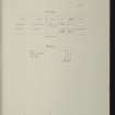
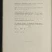
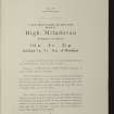
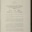
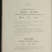
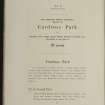
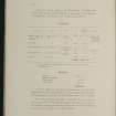
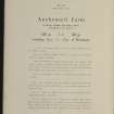
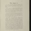
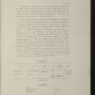
Advertised for sale as part of the Kilmahew Estate in 1919 (information from Estates Exchange).
Archaeological Evaluation (January 2002)
An archaeological field evaluation was undertaken by Headland Archaeology of a possible linear earthwork in the grounds of the former Cardross Assessment Centre (NS 3458 7754) on the north side of the A814 in Cardross, Dumbarton. Cala Homes (West) Ltd has submitted an outline planning application to Argyle and Bute Council to develop the grounds
for residential housing. Local historians have suggested that the linear earthwork may represent the eroded remains of the boundary enclosing King Robert I hunting park.
M Dalland 2002


