
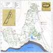
Badentarbat Bay


Building (Post Medieval)
Site Name Badentarbat Bay
Classification Building (Post Medieval)
Canmore ID 115362
Site Number NC00NW 39
NGR NC 0145 0946
Datum OSGB36 - NGR
Permalink http://canmore.org.uk/site/115362


- Council Highland
- Parish Lochbroom
- Former Region Highland
- Former District Ross And Cromarty
- Former County Ross And Cromarty
Field Visit (9 August 1994)
NC00NW 39 0145 0946
Just above High Water Mark on the NE side of Badentarbat Bay, about 160m WSW of the road junction, there are the slight remains of building measuring 29.4m in length from NW to SE by 5.6m in breadth over walls now spread to a thickness of 1.4m. The remains of partitions suggest that it was divided into three compartments. A trackway runs through the building from one end to the other.
(ACHIL94 423)
Visited by RCAHMS (SDB) 9 August 1994

