
Unst, Hoversta


Clearance Cairn(S) (Period Unassigned), Farmstead (Period Unassigned), Farmstead (Norse)(Possible), Quarry (Period Unassigned), Unidentified Pottery (Iron Age)
Site Name Unst, Hoversta
Classification Clearance Cairn(S) (Period Unassigned), Farmstead (Period Unassigned), Farmstead (Norse)(Possible), Quarry (Period Unassigned), Unidentified Pottery (Iron Age)
Canmore ID 115
Site Number HP60SW 15
NGR HP 60057 01757
Datum OSGB36 - NGR
Permalink http://canmore.org.uk/site/115


- Council Shetland Islands
- Parish Unst
- Former Region Shetland Islands Area
- Former District Shetland
- Former County Shetland
HP60SW 15 6005 0175.
Sherds from Hoversta, Uyeasound, were donated to the NMAS by A H Priest, Hoversta.
Proc Soc Antiq Scot 1961
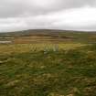
Mr Priest indicated where he found the sherds, at HP 6004 0178, whilst digging into a turf-covered, disturbed area of ground c.30.0m N to S by c.32.0m transversely. It is raised c.1.0m above the surrounding area and a number of large stones protrude from the turf, but form no recognisable pattern. There is obviously an artificial structure here but its nature is impossible to determine.
Visited by OS(RL) 5 May 1969
The sherds can be classified as IA period - possibly pre-broch and comparable with Jarlshof.
Information from A S Henshall, National Museum of Antiquities of Scotland (NMAS), 1969.
A survey was undertaken of potential Norse farmsteads, in addition to those previously recorded in 1994-95. Structures are rectangular and aligned downslope. HP 6007 0175 Hoversta. Complex mound with wall remains in SE corner; 25 x 15m overall N-S. Small later structure built on upper end.
L H Smith 2005
Field Visit (30 April 2010)
What appear to be the remains of a subrectangular building are set end-on into the SW face of a low rise some 165m SW of Hoversta (HP60SW 54). The building, which is situated immediately SW of a later building and planticrub (HP60SW 55), is aligned NE and SW, and has been heavily robbed, surviving best on the SE where a 2m length of coursed outer face is still visible. Some edge-set facing-stones also remain at the SW end, and an orthostat stands on the line of the wall towards the NE end of the NW side, roughly coincidental with where there appears to be a subdivision in the building. An irregular shaped enclosure is attached to the SE side of the building. In addition, there are several quarry scoops on the low rise to the NW, another larger one to the SW (HP 60031 01740) and a row of three clearance cairns immediately S.
Visited by RCAHMS (ARG) 30 April 2010.

