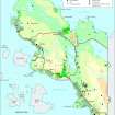
Camascoille
Head Dyke(S) (Post Medieval), Hut(S) (Post Medieval), Lazy Beds (Post Medieval), Township (Post Medieval)
Site Name Camascoille
Classification Head Dyke(S) (Post Medieval), Hut(S) (Post Medieval), Lazy Beds (Post Medieval), Township (Post Medieval)
Canmore ID 114883
Site Number NC01NW 2
NGR NC 0020 1558
NGR Description centred on NC 0020 1558
Datum OSGB36 - NGR
Permalink http://canmore.org.uk/site/114883
- Council Highland
- Parish Lochbroom
- Former Region Highland
- Former District Ross And Cromarty
- Former County Ross And Cromarty
Field Visit (17 May 1994)
NC01NW 2 centred on 0020 1558
On the E of the Rubha Coigach peninsula there is a crofting township comprising two roofed buildings, four unroofed buildings, three huts, two phases of head-dyke, some rig, lazy-beds and clearance cairns.
The buildings range from 9.7m to 13m in length by 2.8m to 4.7m in breadth within faced-rubble walls, 0.6 to 0.9m thick (ACHIL94 12-3, 15-6). Two of the buildings are sub-divided into two compartments (ACHIL94 12 and 15), of which one has a byre-drain in its E compartment (ACHIL94 12). Two stand to gable height, one of which is in the process of being reroofed (ACHIL94 12); they represent the most recent structures to be abandoned, whilst the other two are almost completely robbed of their walls (ACHIL94 15-16) and were abandoned at an earlier stage. This is reflected to some extent by the 1st edition OS 6-inch map (Cromartyshire 1881, sheet iB) which depicts the two gable high structures as roofed (ACHIL94 12-13) and one of the reduced buildings (ACHIL94 15) as unroofed. Both the gable-high structures were heated by fireplaces and have been extended at both ends.
The five huts or pens are scattered across the site. Two (ACHIL94 14, 17) are similar in size and construction, measuring some 4.2m in length by 2.1m in breadth within faced-rubble walls 0.9m and 0.55m thick and standing to 0.25m and 1.2m high respectively. A third hut (ACHIL94 47, NC 0010 1584), which is much reduced, measures 7.4m from ESE to WNW by 3.5m transversely over low heather-covered stony banks with an entrance in the ESE. The other two are smaller; one (ACHIL94 48, NC 0009 1584), which occupies the SE side of an enclosure attached to the outer of the two head-dykes, measures 3.2m by 2m, whilst the other, which lies amongst broken peat-covered ground between the two head-dykes (ACHIL94 46, NC 0012 1554), measures 3.6m by 1.8m.
Of the two head-dykes, the inner and later comprises a drystone wall, which becomes peat-covered in the wetter parts of the site. The outer and earlier head-dyke is completely overgrown, but appears to have been an earthen dyke. It describes an arc on the NW and W about 75m beyond the inner dyke, but on the SW it cuts a diagonal course within the ambit of the inner dyke, before turning (NC 0029 6404) to run for about 75m on the same line as the later head-dyke, which overlies it, before diverging (NC 0036 1548) to run down to the cliffs outside the inner dyke. Within the head-dyke the lower slopes of the township are covered with lazy-beds as far as the cliff-edge and even on the slopes of cliff collapse. Between the lazy-beds and the inner head-dyke, there is some rig-covered ground and clearance heaps. This area is sub-divided by roughly parallel stone dykes into at least three plots that indicate the status of the settlement as a crofting township.
May's survey of 1758 (SRO, RHP 85395) indicates that there was a shieling at this location called "Lammas Eaillie", presumably a transcription error for Camascoille. The 1st edition of the OS 6-inch map depicts one unroofed and eight roofed buildings, of which four were not visible at the date of survey, three enclosures and a head-dyke (Cromartyshire 1881, sheet iB). According to Crofters' Statistics collected in the 1880s (Baldwin 1994), the settlement was established as a crofting township in 1831.
(ACHIL94 12-17, 46-8)
Visited by RCAHMS (PJD) 17 May 1994
J R Balwin 1994


