
Scheduled Maintenance
Please be advised that this website will undergo scheduled maintenance on the following dates: •
Tuesday 3rd December 11:00-15:00
During these times, some services may be temporarily unavailable. We apologise for any inconvenience this may cause.
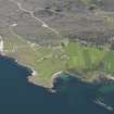
Raasay, Creachan Lodge


Dyke(S) (Period Unassigned)(Possible)
Site Name Raasay, Creachan Lodge
Classification Dyke(S) (Period Unassigned)(Possible)
Canmore ID 11458
Site Number NG53NE 11
NGR NG 552 379
Datum OSGB36 - NGR
Permalink http://canmore.org.uk/site/11458


- Council Highland
- Parish Portree
- Former Region Highland
- Former District Skye And Lochalsh
- Former County Inverness-shire
NG53NE 11 552 379
In Boswell's Private Journal of the Hebridean Tour, ed Pottle, C H and Bennett, F A (1963), he refers to a line of 'dry stone buildings' running across Raasay. Perhaps this is to be associated with the parallel lines of stones prominently visible at a point 100m W of Creachan Lodge, crossing the road and the stream c.200m N of the Lodge and visible for some distance up the hillside. The line is not continuous, but the two lines are distinctly separate, of contiguous natural boulders for several stretches; they do not suggest a collapsed wall.
Information contained in Letter from Mr R Sharpe, Trinity College, Cambridge to Ordnance Survey, 15 February 1976.
NG 547 383 and NG 552 402 The survey of Oskaig and Holoman was carried out by ACFA in April 1995 as part of a continuing survey of the Island of Raasay. The survey team were: I Hughson, A Johnstone, A Macdonald, W Duggan, G Hearns, D McKay, J Waterton, J Macdonald and J S Wood.
NG 5523 3788 Two parallel lines of stones.
J Macdonald and J S Wood 1995.

