
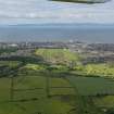
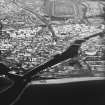
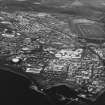
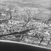
Ayr, Craigie, Whitelees Road, Racecourse


Racecourse (20th Century)
Site Name Ayr, Craigie, Whitelees Road, Racecourse
Classification Racecourse (20th Century)
Alternative Name(s) Ayr Race Course
Canmore ID 114464
Site Number NS32SW 142
NGR NS 3489 2214
NGR Description Centred NS 3489 2214
Datum OSGB36 - NGR
Permalink http://canmore.org.uk/site/114464


- Council South Ayrshire
- Parish Ayr
- Former Region Strathclyde
- Former District Kyle And Carrick
- Former County Ayrshire
NS32SW 142.00 centred 3489 2214
Race Course [NAT]
OS (GIS) MasterMap, July 2010.
NS32SW 142.01 NS 34819 22344 Grandstand

