
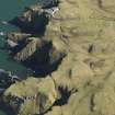
St Abb's Head


Enclosure (Post Medieval), Garden (Post Medieval)(Possible)
Site Name St Abb's Head
Classification Enclosure (Post Medieval), Garden (Post Medieval)(Possible)
Canmore ID 114060
Site Number NT96NW 44
NGR NT 91197 69163
Datum OSGB36 - NGR
Permalink http://canmore.org.uk/site/114060


- Council Scottish Borders, The
- Parish Coldingham
- Former Region Borders
- Former District Berwickshire
- Former County Berwickshire
NT96NW 44 91199 69172
A rapid coastal survey was undertaken by GUARD of the S shore of the Firth of Forth from Dunbar to Stirling and along the N shore of the Forth to the Fife border. The area from Dunbar to St Abb's Head was covered by visits to two specific areas, Chapel Point/Skateraw and St Abb's Head itself. The coastal strip extending from the high water mark to 50m inland was examined. A gazetteer of all sites including listed buildings, designed landscapes, scheduled and unscheduled monuments was produced. The survey covered seven local authorities, Clackmannanshire, Edinburgh City, East Lothian, Falkirk, Scottish Borders, Stirling and West Lothian. The survey identified a number of new sites. Full details of the survey can be consulted in the report held by the NMRS.
Sponsor: Historic Scotland
GUARD 1996
Rectangular enclosure seen on 1946 aerial photographs, but not marked on 1:10 000 map. B17 7002-3 15/4/46.
Site recorded by GUARD during the Coastal Assessment Survey for Historic Scotland, 'The Firth of Forth from Dunbar to the Coast of Fife' 1996.
Reference (1996)
Rectangular enclosure seen on 1946 aerial photographs, but not marked on 1:10 000 map. B17 7002-3 15/4/46.
Site recorded by GUARD during the Coastal Assessment Survey for Historic Scotland, 'The Firth of Forth from Dunbar to the Coast of Fife' 1996.
Sbc Note
Visibility: This is an upstanding earthwork or monument.
Information from Scottish Borders Council

