
Gullane Sands, Jophies Neuk


Anti Tank Blocks (20th Century)
Site Name Gullane Sands, Jophies Neuk
Classification Anti Tank Blocks (20th Century)
Alternative Name(s) Gullane Point
Canmore ID 113427
Site Number NT48SE 66
NGR NT 4643 8260
NGR Description NT 4645 8254 to NT 4641 8276
Datum OSGB36 - NGR
Permalink http://canmore.org.uk/site/113427


- Council East Lothian
- Parish Dirleton
- Former Region Lothian
- Former District East Lothian
- Former County East Lothian
NT48SE 66 4645 8254 to 4641 8276
For similar anti-tank blocks see NT48SE 65, NT48SE 66 and NT48SE 67.
Site recorded during a rapid coastal survey undertaken by GUARD of the S shore of the Firth of Forth from Dunbar to Stirling and along the N shore of the Forth to the Fife border. A gazetteer of all sites including listed buildings, designed landscapes, scheduled and unscheduled monuments was produced. Full details of the survey can be consulted in the report held by the NMRS.
NT 462 825 WW2 defences
Sponsor: Historic Scotland
GUARD 1996
System of WW2 anti-tank blocks visible on 1946 aerial photographs. B108 5312-13 15/4/46.
Site recorded by GUARD during the Coastal Assessment Survey for Historic Scotland, 'The Firth of Forth from Dunbar to the Coast of Fife' 1996.
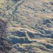
Two lengths of anti-tank blocks running N-S over the coastal area of Gullane Links with a spur of blocks trending W off to the beach at NT 4643 8260.
The square concrete blocks are in single, double and triple rows and form an impressive group. Further S many have been removed, with the occasional one remaining marking the course of the rows. Near the sewage works (NT 4670 8162), one block has been left and has been inscribed on its top surface when the concrete was wet " No.11. T Black. 14-8-40/ Worris". Another block in a double line of blocks has been inscribed on the top surface 'HC 22/8/48'. Many more blocks survive near Gullane Point (see also NT48SE 67 and NT48SE 68 )
J A Guy 1997; NMRS MS 810/5, 148-51, 153
Examination of vertical air photographs (RAF 540/801, 3260, flown 4 July 1952) combined with some field walking reveal a double row of anti-tank blocks running N from near to the wooden bridge over the Peffer Burn, (NT c.4688 8067), to a point SE of Gullane Point (NT 4645 8254). At this point the rows quadruple for some 70m and then bifurcate. Of the line running N from the Peffer Burn to NT 4645 8254, some fourteen single blocks survive from the continuous double row originally constructed. A further eight holes for blocks were also found in the marshy area immediately to the N of the Marl Loch (NT c.4669 8110).
Where the lines bifurcate (NT 4645 8254), one double line of blocks continues NW, and the second line, from which a few blocks have been removed, runs W to a point at about NT c. 462 826. From this point it then turns NE to rejoin the direct line of double blocks at NT 4641 8276, where they cross a track which leads to a sand quarry. This section of blocks forms, in plan, a defensive box covering the approaches from the Aberlady Bay direction. The 'box' of blocks also surrounds a large sand dune on which was found a pit with two metal brackets fixed into the ground.
From NT 4641 8276, the double line of blocks continues NE through an area of gorse to a point at NT c.464 828, where turns SE, from which a quadruple line of blocks incorporating a later built small hut, runs for about a 150m, then turns NE for 50m and ends. The short section of blocks to the N of a tee platform on the golf course, have fallen or been pushed over. It is possible that it was intended to continue this line to link with the group at NT 467 830 (NT48SE 68), but as yet no evidence for this can be found on the ground or from aerial photographs.
One further inscribed block was found in the western loop and noted as '(Y?) EFL', PR IC' no date could be seen.
Information from RCAHMS (DE), February 2001.
Reference (1996)
System of WW2 anti-tank blocks visible on 1946 aerial photographs. B108 5312-13 15/4/46.
Site recorded by GUARD during the Coastal Assessment Survey for Historic Scotland, 'The Firth of Forth from Dunbar to the Coast of Fife' 1996.

