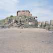
Edinburgh, Cramond Island, Anti-shipping Barrier
Anti Shipping Barrier (20th Century)
Site Name Edinburgh, Cramond Island, Anti-shipping Barrier
Classification Anti Shipping Barrier (20th Century)
Alternative Name(s) Forth Defences
Canmore ID 113097
Site Number NT17NE 118
NGR NT 1933 7779
NGR Description NT 1912 7738 to NT 1954 7819
Datum OSGB36 - NGR
Permalink http://canmore.org.uk/site/113097
- Council Edinburgh, City Of
- Parish Edinburgh (Edinburgh, City Of)
- Former Region Lothian
- Former District City Of Edinburgh
- Former County Midlothian
NT17NE 118 1912 7738 to 1954 7819
(NGR taken on central point)
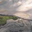
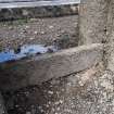
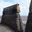
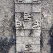
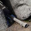
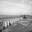
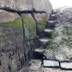
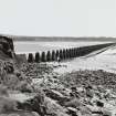
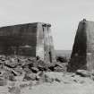
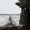
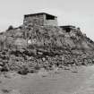
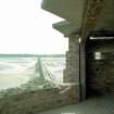
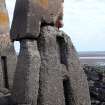
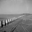
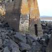
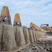
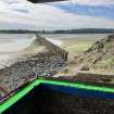
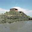
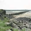
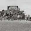
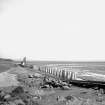
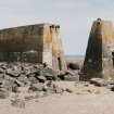
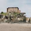
An anti-shipping barrier constructed during the Second World War to close the gap between Cramond Island and Cramond. Protected by a small coast battery located at the N end of the barrier on Cramond Island 'The Knoll' (NT17NE 100). A large diameter wire was placed along the top of the barrier, the fixing points still visible on each of the pillars.
Information from RCAHMS (DE) Sepetember 1996
A rapid coastal survey was undertaken by GUARD of the S shore of the Firth of Forth from Dunbar to Stirling and along the N shore of the Forth to the Fife border. The area from Dunbar to St Abb's Head was covered by visits to two specific areas, Chapel Point/Skateraw and St Abb's Head itself. The coastal strip extending from the high water mark to 50m inland was examined. A gazetteer of all sites including listed buildings, designed landscapes, scheduled and unscheduled monuments was produced. The survey covered seven local authorities, Clackmannanshire, Edinburgh City, East Lothian, Falkirk, Scottish Borders, Stirling and West Lothian. The survey identified a number of new sites. Full details of the survey can be consulted in the report held by the NMRS.
NT 193 778 Structure
Sponsor: Historic Scotland
GUARD 1996
A row of concrete blocks is laid across the sand, from the mainland to Cramond Island. These blocks are in the form of elongated pyramids up to 3 m high. The blocks are spaced at approximately 1.5 m intervals, with one exception. These are from a 2WW anti-shipping barrier.
Site recorded by GUARD during the Coastal Assessment Survey for Historic Scotland, 'The Firth of Forth from Dunbar to the Coast of Fife' 10th March 1996..
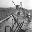
Anti-ship boom with concrete piers between Cramond and Cramond Island. The barrier once supported concrete slabs and a wire hawser ran through the hoops on the top.
J A Guy 1997; NMRS MS 810/5, 50, 54
NT 190 771 (area) A programme of archaeological works was undertaken in advance of the construction of a new pumping station, rising main and associated works at Cramond.
NT 1901 7719 - NT 1942 7792 A watching brief was undertaken on trenching works associated with the insertion of a new pipe alongside the western side of the causeway and immediately adjacent to the existing Cramond outfall pipe. The watching brief extended for a distance of 875m from the existed sewage pumping station, at the head of the breakwater. This work was undertaken immediately alongside and to the W of the anti-shipping barrier (NMRS NT17NE 118) linking the Cramond breakwater with Cramond Island. No significant archaeological features or artefacts were encountered.
Sponsor: East of Scotland Water.
J Gooder 2001
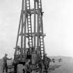
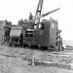
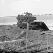
These pillars were approximately 1.2metres shorter for the WW2 period (built 1938 by the Yorkshire Hennebique Company) and did not have the hawser strung along the top. They were raised in height in 1946 and the added structure was topped with a large diameter hawser.
(Vertical air photographs (106G/SCOT/UK117, frames 5016 & 5017, flown 1946), may show this construction work being carried out).
Information to RCAHMS via e-mail from Mr J Dods (Cramond Heritage Society), April 2006
Field Visit (10 March 1996)
A row of concrete blocks is laid across the sand, from the mainland to Cramond Island. These blocks are in the form of elongated pyramids up to 3 m high. The blocks are spaced at approximately 1.5 m intervals, with one exception. These are from a 2WW anti-shipping barrier.
Site recorded by GUARD during the Coastal Assessment Survey for Historic Scotland, 'The Firth of Forth from Dunbar to the Coast of Fife' 10th March 1996..
Watching Brief (2001)
NT 190 771 (area) A programme of archaeological works was undertaken in advance of the construction of a new pumping station, rising main and associated works at Cramond.
NT 1901 7719 - NT 1942 7792 A watching brief was undertaken on trenching works associated with the insertion of a new pipe alongside the western side of the causeway and immediately adjacent to the existing Cramond outfall pipe. The watching brief extended for a distance of 875m from the existed sewage pumping station, at the head of the breakwater. This work was undertaken immediately alongside and to the W of the anti-shipping barrier (NMRS NT17NE 118) linking the Cramond breakwater with Cramond Island. No significant archaeological features or artefacts were encountered.
Sponsor: East of Scotland Water.
J Gooder 2001
Publication Account (2001)
AOC report. Watching brief and evaluation trenches revealed 3 shallow ditches, one of which contained bone, Roman pot and a metal ring. Another has a possible post-medieval date.
Sponsor: East of Scotland Water.
J Gooder 2001


