Pricing Change
New pricing for orders of material from this site will come into place shortly. Charges for supply of digital images, digitisation on demand, prints and licensing will be altered.
Skye, Dun A'cheitechin
Broch (Iron Age)(Possible)
Site Name Skye, Dun A'cheitechin
Classification Broch (Iron Age)(Possible)
Canmore ID 11287
Site Number NG44NW 8
NGR NG 4175 4785
Datum OSGB36 - NGR
Permalink http://canmore.org.uk/site/11287
- Council Highland
- Parish Snizort
- Former Region Highland
- Former District Skye And Lochalsh
- Former County Inverness-shire
NG44NW 8 4175 4785.
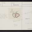
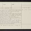
(NG 4175 4785) On the SW side of Skeabost Bridge, a rocky knoll named Dun a Cheitechin carries the remains of a broch and its outworks. The site is now wholly turf-covered but it is possible to pick out, on the highest point of the knoll, a roughly circular building c. 20.0m in external diameter, with walls c. 4.0m thick, almost certainly a broch.
A less substantial wall forms an outwork enclosing the summit. No entrance to the broch is visible, but a gap in the NE corner of the outer defence seems to be original since it coincides with the approach route from the N (up a ridge and through a natural cleft in the rocks.) On the pasture below the knoll, to the E, are about 4 ruined houses.
Dun a Cheitechin as misapplied on the 1904 6" to the rocky knoll immediately SSE. The correct name for this latter hill (NG 418 475) is Dun na h'Uamha or Cave Hill. The name Caroline Hill applies to the lower slopes of Dun a' Cheitechin. (Visible on RAF air photographs CPE/Scot/UK/175: 1197-8)
Visited by OS (C F W) 24 June 1961; Information from Mr Gilles, Tote, Skeabost.
(NG 4175 4785) Dun a Cheitechin (NR)
OS 6"map, (1966)
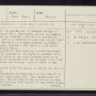
Probably a broch but its classification rests solely on the size of and shape of the surviving mound rather than on architectural detail of which only three or four outer facing stones on the W arc can be seen. The turf-covered mound, maximum height 2.0m, has been extensively quarried and there are no traces of wall faces to ascertain the wall thickness as described and planned by previous OS field surveyor whose plan, is, to say the least, ambitious.
The outer face of the outwork can be seen intermittently in the W arc, and one inner facing stone in this arc suggests a wall thickness of 2.6m.
The entrance near the NW corner is 1.7m wide and is flanked on each side by two earthfast stones. The wall in the E and S has been robbed and its course is scarcely distinguishable but several stones protruding from the turf suggest it followed the rim of the eminenece.
Visited by OS (I S S) 12 October 1971.
Publication Account (2007)
NG44 2 DUN a' CHEITECHIN
NG/4175 4785
Possible broch in Snizort, Skye, consisting of a much-quarried, turf-covered mound standing on a round-topped, rocky knoll; no structural features can be seen except a few facing stones of the outer wallface [1]. Faint traces of an outer wall, or turf-covered bank [3, plan], can be seen enclosing the summit, and there are signs of an entrance through this in the north-west corner [1].
Sources: 1. NMRS site no. NG 44 NW 8: 2. MacSween 1984-85, 45, no. 29 and fig. 29: 3. Swanson (ms) 1985, 831-32 and plan.
E W MacKie 2007
Note (21 January 2015 - 1 November 2016)
Situated on a flat-topped hillock that rises above the moorland to the S of Skeabost Farm, there are traces of a heavily robbed fortification enclosing a broch that has been reduced to a mound of rubble some 20m in diameter. The outer wall encloses a roughly oval area measuring about 43m from N to S by 29m transversely (0.08ha), though it to has been reduced to little more than a band of rubble; the outer face is intermittently visible on the W flank, where a single possible inner facing-stone indicates an original thickness of 2.6m. The entrance is on the NW, coinciding with a cleft leading up from a natural gully cutting through the hillock.
Information from An Atlas of Hillforts of Great Britain and Ireland – 01 November 2016. Atlas of Hillforts SC2730


